Philippe shifted the start times backwards in anticipation of the time it would take everyone to finish. Our group left the lodge at 6:30 in the dark, chilly, rainy morning. The following groups were now spaced 45 minutes apart, to give the support team time to get to the ravito and finish locations before the speedsters.
I ran with a micro LED light in one hand for maybe 15 minutes, not wanted to carry my full headlamp the entire day when I needed a bit of light only briefly. It was rather eerie starting in the dark, following Philippe down a small drop before starting our first uphill of the morning. Soon the dawn started filtering through the trees and Philippe bade me goodbye for now. This morning's trail was pretty straightforward.
The climbs were coming pretty easily to me by now. It was still work, don't get me wrong, and I had a maximum sustainable speed that wasn't all that fast, really. But I had determined that it was OK to breathe harder than I was used to for a long run. As long as my legs could handle it, everything else fell into place. I wasn't afraid of making good use of my lungs. I guess I just need a three-day warm-up, and I can do things I didn't know I had in me.
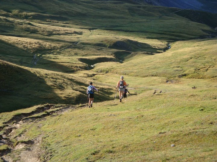
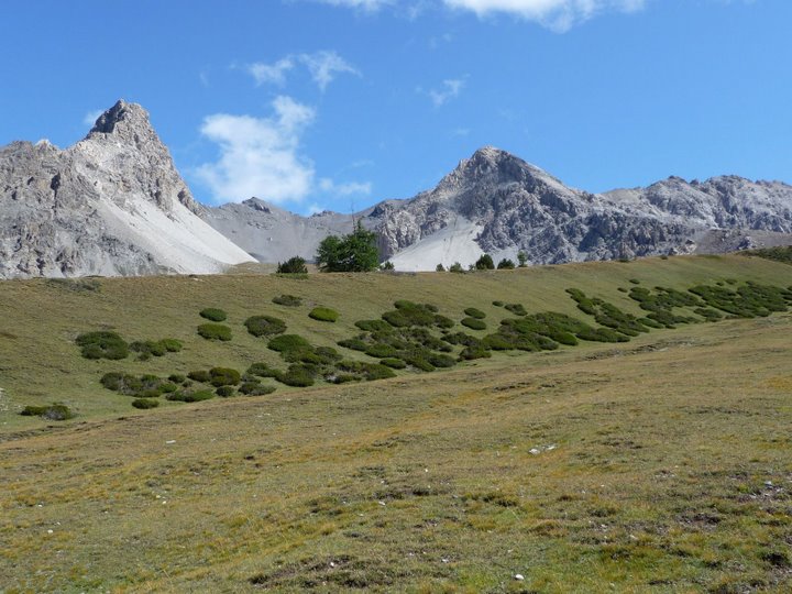
The sky got lighter as I climbed up through trees, through mist, and then up into grassy fields.
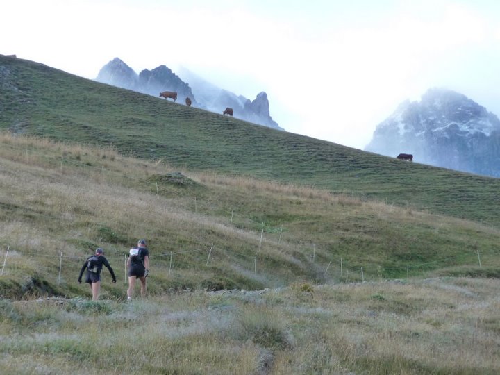
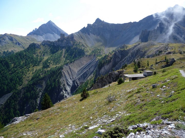
I wished I could see more of the scenery, but low clouds covered many of the peaks. The parts I saw were beautiful.
Through farmland and pastures, I continued up toward the Col de la Vallee Etroite. I followed a route I had taken last time, around the left side of a big valley. The markings confused me a bit, but I could see where I was headed. Later I learned from the map that the GR5 actually goes up the center of the valley. It didn't look much harder or easier than what I had done.
Several trails joined together at or near the col. I couldn't see the trail sign I was looking for, so I broke out the map to make sure I didn't take off down the wrong way. OK, everything looks right. Not a minute later I spotted the sign. Better to be slower and right than faster and wrong.
I flew down the first descent, always feeling great during the first downhill of the day, and it wasn't a super long one for once. Just a bit of steep, rocky stuff, through more pretty fields and across a creek. I found a "Pont" sign pointing back toward the wooden bridge I had just crossed, which struck me as funny for some reason, because the bridge was about as obvious as they come.
A long, gentle, smooth downhill road guided me to the next point of interest, the Refuge Tre Alpini - that's right, we're heading to Italy today! Italy always puts me in a good mood. We wouldn't be staying long, but the Italian influence on the French side of the border still made me happy. I was always ready with a "buon giorno!" to any hikers I heard speaking Italian. Oh, and the evening food for the next couple of days was perhaps the best of the race.
I saw a side trail heading off to the left, but without GR markings, so I stayed on the road. Other runners took the trail, and I think the results were a wash. For now, I was still alone in front of everyone with an even bigger head start to hold onto as long as I could.
I made the right turn up to the refuge, pausing briefly to contemplate a really confusing sign even though I knew exactly what I was supposed to do. It seemed to suggest to NOT go this way (red/white marks in the form of an X). Huh. Oh well. I continued up to a water fountain, filled a SPIZ to put in my pack for later, and started up the next hill.
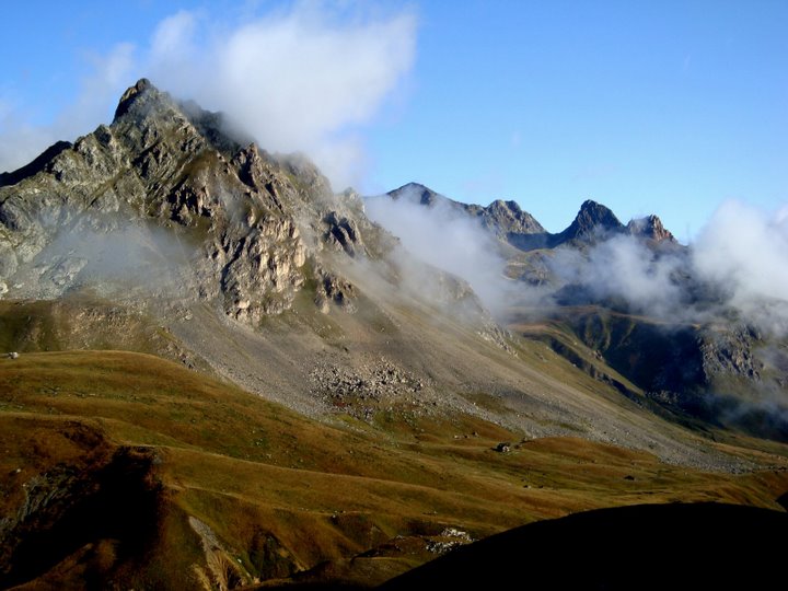
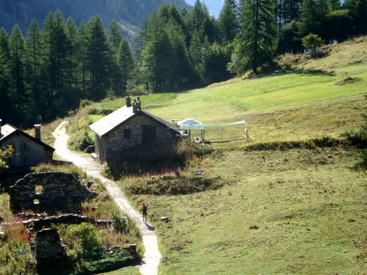
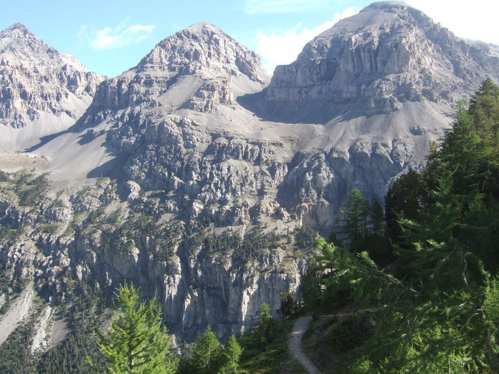
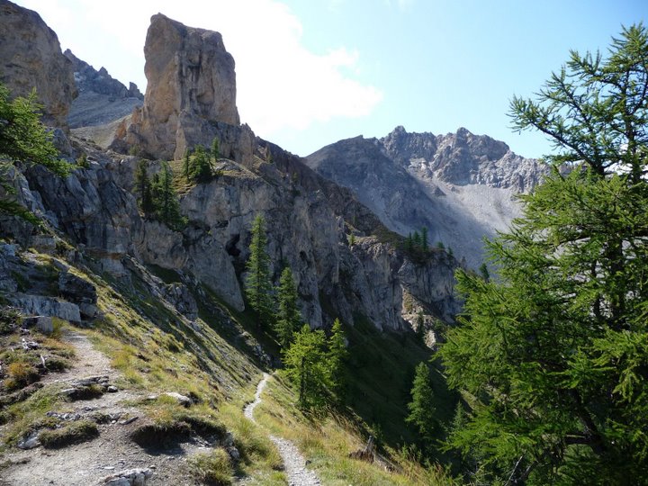
Scenery around this area was gorgeous:

I went up a nice little shaded climb with perfectly graded switchbacks. The trail signs were exceedingly clear about not cutting corners, which was certainly important because there was a lot of trail erosion going on. My poles and I were very happy with the slope and I felt I made good time. Partway up I noticed a guy on a bike ahead of me. Huh. I had not seen much of that on the GR5.
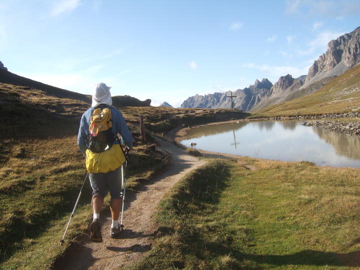
On the more technical sections I made up ground on the cyclist. Near the top he moved over to let me by, and I congratulated him on making it up the hill. He mentioned something about it being a bit difficult on a bike, and I heartily agreed! The trail got easier and it was my turn to let him go by. We topped out together at the lake on the Col des Thures.
Except when I was there, it was enshrouded in fog. It wasn't quite so easy to follow the GR marks, but luckily Philippe had enlisted the aid of a local guide who had added some pink dots along the way. That helped a lot and I had no trouble along the shallow col, even though I couldn't see very far ahead.
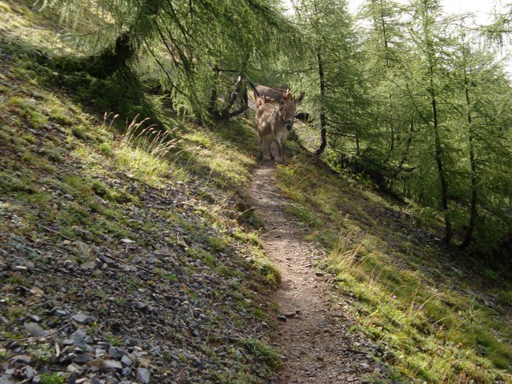
After what seemed like too long, I found a trail intersection and finally got to veer left like I'd wanted to do for the last kilometer. A short traverse, a short climb, past the spot where donkeys would congregate later to block the trail for several runners:
I ran over the top of the small hill and started down a steep slope. This isn't a fun descent, mostly because you can see the bottom through the trees and it looks oh-so-close even though it's actually 400 meters down. I started a "don't look down" policy, which helped me be patient. Soon enough, I was at the bottom for real.
It was an easy run alongside a paved road toward the ravito. I recognized Philippe running toward me, and he accompanied me the rest of the way to the van, asking me questions about the additional pink markings ("perfect!") and the fog. I walked up to the food table and greeted the gang. Marie-Claude handed me a cup of Coke, which made me laugh - she had been paying attention and knew what I liked!
Soon I was away, starting up the next steep set of switchbacks. I'm usually a fan of shorter climb/descent intervals, but I actually think that is part of what makes day 8 more difficult. Partway up I heard cheering, so I figured someone (maybe Laurent or John) was only 5 minutes behind.
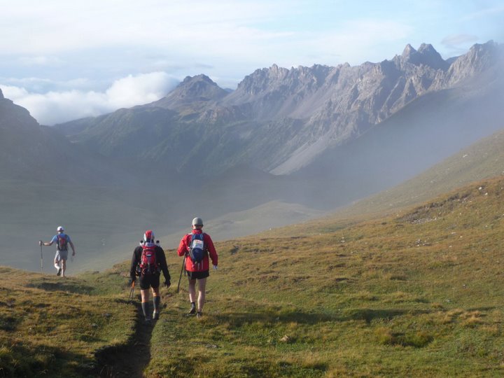
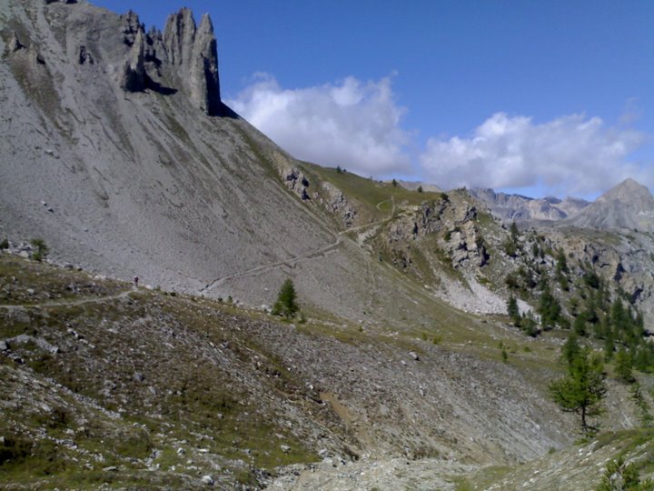
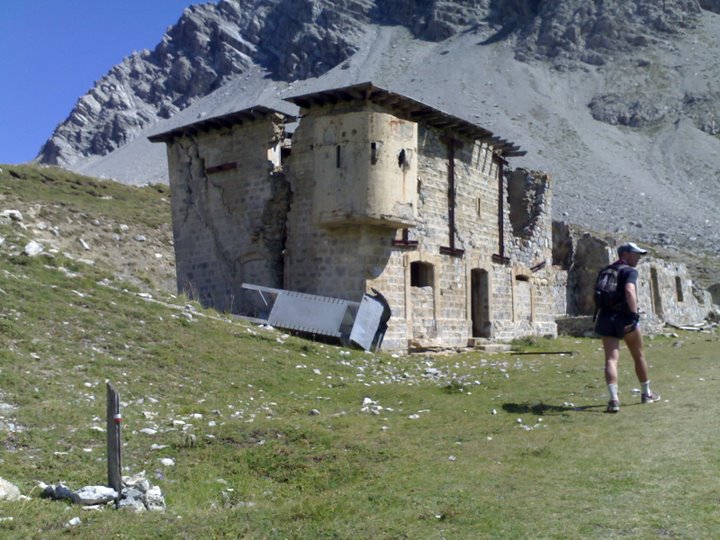
The ascent took longer than I expected, but eventually I was above treeline and heading toward Italy and the neatest cirque of the race. The route hugged the Italian border, passed several old military buildings, and then dropped down into Italia.
On the traverse across the cirque, I looked back a couple times and finally spotted someone in orange running toward me. Must be Laurent. Bonjour Laurent!
The scenery continued to be awe-inspiring as I ate a cookie and followed in Laurent's quickly-fading footsteps.
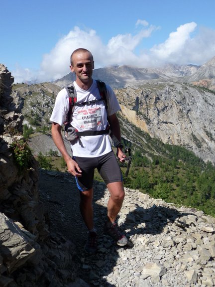
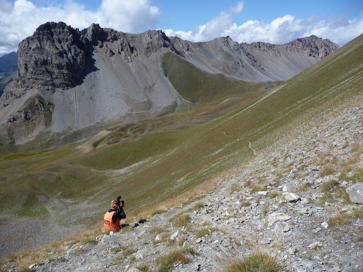
Rodolphe on this section of trail:
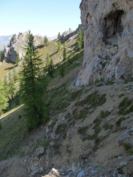
I popped over a ridge and discovered a really narrow trail down a steep drop. Oh yeah, I remember this now. More traverse, through small washes, then through the woods a short ways before heading up to the final col of this section. Another thing that made this day difficult is that we never went up just once at a time - each section had multiple high points, lots of ups and downs.
I crossed back out of Italy, that trip was way too fast. There were more military buildings, then a big drop down to a river crossing where we would rejoin the GR5.
The GTA markings on the final bit of descent led straight down a rocky wash. It wasn't an actual trail, as far as I know, but it cut off some distance so I didn't complain. I surfed a bit of gravel on the side of the wash and also found some large rocks to step down like stairs. It took some concentration but the bottom came quickly (and no, I hadn't fallen down to it, thank goodness).
While running up a dirt road toward the creek crossing, John ran up behind me. Hi husband! He was doing well, he just couldn't stay with Laurent on the downhills. We both remarked that it was much better weather than last time, much cooler. I didn't need to soak my entire body in the creek this year.
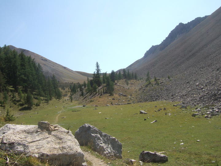
We crossed the creek and John started powerwalking strongly up the hill. Always a good model to try to emulate, even if there's no way I can keep up. The trail led steeply upward through woods and then leveled out in a wide open valley
Time for my music! But not so pell-mell-crazy today, just some entertainment. One song made me laugh, Paolo Nutini's "New Shoes" - I had just been admiring the multiple holes in John's shoes the night before, wondering if/when he was going to switch to his new ones. My shoes, amazingly, were holding up with zero holes so far.
A bit of O-Zone's "Dragostea Din Tei" (otherwise known as the "Miya-hee" song) got me up to the Col de Dormillouse. I looked back briefly but didn't see anyone below me in the valley. One more col! But first a short drop that only made the last little climb to Col de la Lauze that much harder. It was surprisingly steep as well.
Near the top I spotted a race photographer (his name might be Francesco, if I remember right). Of course I had to try to look good for the picture. That took just about all the energy I had left! Some hikers at the top cheered me on, then I was on the final downhill of the day.
This was another long knee-jarring downhill, so I took an ibuprofen and did my usual tricks like changing strides, dancing to music, and walking backwards occasionally. This seemed to work reasonably well. Plus I had Taylor Hicks crooning in my ears, which always makes things better. Looks like I can break 8 hours - awesome. Last time it had taken me over 10.
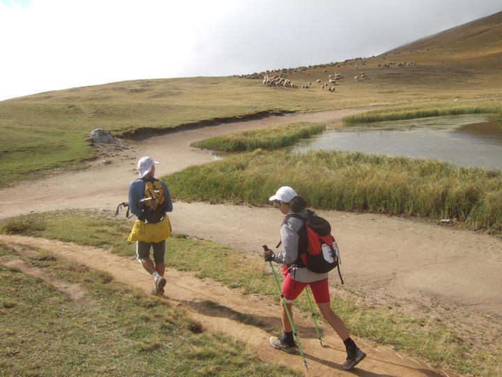
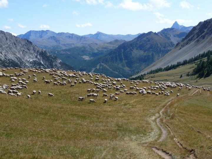
Sheep that appeared after I had passed by:
More hikers, traces of civilization. Finally I spotted the Village du Soleil and ran around to the back to find the finish line. One more day down!
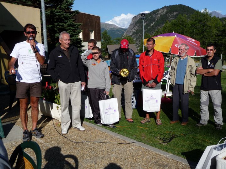
We had some excellent post-race pasta and tabouleh, and it was fun cheering for runners bombing down the last hill to the finish line. Everyone made it through a tough stage. Philippe and Jean-Patrick provided commentary on the microphone for the restaurant patrons, then there was an awards ceremony for the stage winners. We brought home a couple "Montgenevre" backpacks that we actually use.
John finished 18 minutes behind Laurent, which was fine with him. I gained some time over Sylvie, closing in on an hour overall lead. John and I continued to be cautiously optimistic, as we were approaching the days when big things could start to go wrong for anybody.
During the briefing a couple people asked me to consider moving to the second starting group. I would certainly be welcome there, I was just very happy starting earlier. I told Philippe that if he needed me to change, I would. His main concern was that I was getting to the ravitos too quickly. I didn't think I was much ahead of Laurent (if at all) at any ravito so far. Philippe said for now I was OK in group 1.
We had a nice 3-person room to share with Pascal. Buffet dinner and breakfast was good, especially since it wasn't too crowded. Philippe introduced Gilles Rostollan who would be our local guide for the Queyras section of the course. We made good use of the laundry facilities, since I was pretty sure those would be the last available machines until after the race. Then it was time for bed.
Results:
John = 5:49:52 / 2nd among full-course runners (overall placing = 2nd)
Marcy = 7:46:06 / 10th among full-course runners (overall placing = 12th)