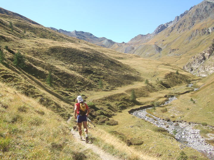
Our start times were moved up half an hour from yesterday but the 45-minute gap between groups remained in force. I was glad to be starting in the daylight again. I took the lead as we left the vacation village and ran on a small trail toward Montgenevre.
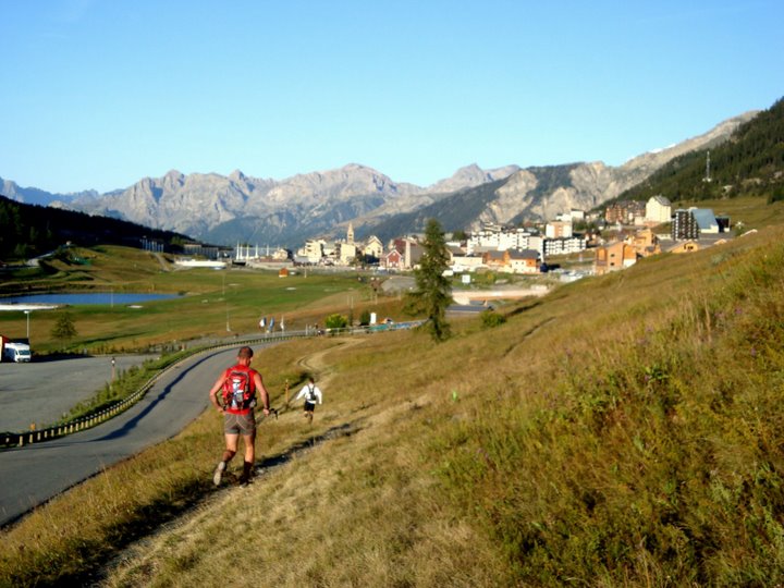
We followed Gilles' pink spray marks alongside the road and across toward the bottom of some ski lifts. It was a slightly different route from last time, but well marked. Gilles led us uphill on a tour of the mountain bike trails. Tiny switchbacks and little dips, a few unnecessary detours through the woods, it all made me laugh. Some of the intersections required vigilance to stay with the marks, but I kept careful watch. At one point I wondered what the heck Gilles was up to, when he took us across a field that didn't appear to have an actual trail through it, but he apparently knows the area really well.
I climbed above treeline and found real trail markings, eventually leaving the ski area and bike trails behind. It was a beautiful morning to be out for a walk. I topped out near an old border house (we were still near Italy) and started a short run down the other side.
The trail passed by a small lake and continued down in a lovely manner, gently winding, gently dropping. I loved it. During this stretch I managed to eat a cookie, blow my nose, and apply lip balm, all while running and holding onto my poles. I did have to stop for a bathroom break, however.
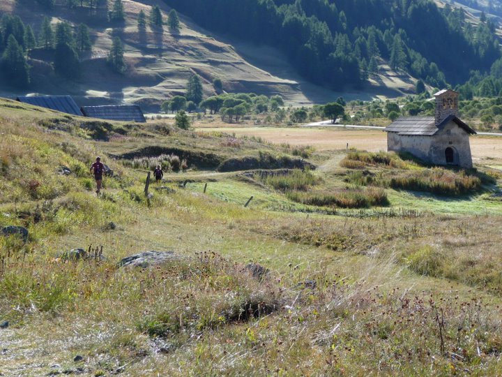
At the bottom the pink markings pointed past a couple small buildings and toward a traverse through a field. A dog threatened with barking but kept his distance. I saw a woman working in a garden as I passed a small church and continued toward the fields.

I was making good time when I came over a rise and completely lost track of the markings. I felt like I knew where to go and didn't want to spend time with the exact details, so I headed up toward a small shelf at the edge of the field. It had a vague trail that I remembered from last time. I ended up doing a tad extra climbing to reach a road at the other end, but mostly I just paralleled what I now know was the correct (lower) route.
My instinct was to head toward the main road, but I was back on Gilles' markings so I followed them through another field. When they led off into the grass I debated not sticking with them, but I did.
When I lost the trail completely, I exclaimed out loud, "oh for heaven's sake!" I was within 2 seconds of giving up and crossing the 20 meters to the road that was RIGHT THERE when I caught sight of another piece of flagging leading through yet another offroad section. Luckily that one finally brought me to the road for real; enough was enough.
I had a nice little run on the road and then on the trail alongside a pretty creek. I knew it was a fair distance before the next big climb, so I relaxed and tried to throw in a bit of speed just for fun. A bit later I reached the end of the valley and a refuge where I filled a SPIZ baggie and water bottle before walking toward the next challenge.
It was a good 600 meter climb up to the Col de Peas. All wide-open and dry (except for a creek through the middle of the valley), it was typical of the Southern Alps. After a short steep start, I headed toward the flatter middle section.
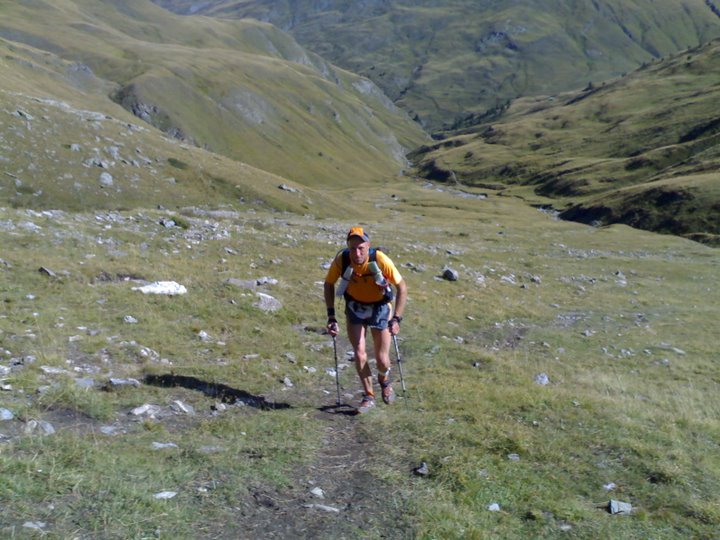
As I was climbing upward, I looked back to see a figure in orange who was positively flying up the hill. I stopped to gape - surely Laurent hadn't made up 90 minutes on me already? How was that possible? I climbed further and pondered.
I figured out that it must be Xavier who was apparently filling in as a SOMFY runner today. He had started 45 minutes back and would finish third today. Oh, thank goodness, that makes much more sense.
Here is Laurent in the same stretch a while later:
I was aware of a challenging steep section toward the top, so I geared down and focused on posture and poles. I passed a couple hikers moving slowly with huge packs. Soon I was at the top, looking toward the next set of mountains that would welcome us in the next couple days.
It was a long 1300-meter drop to the next low point at Chateau-Queyras. The final steep section was the part I wasn't looking forward to. But for now, I enjoyed the interesting trail down from the top. Xavier passed me and we exchanged greetings.
After a bit of descent, the trail markings and Gilles' markings indicated to head to the right along a traverse. I remembered this being a mental challenge, to stay on the trail when it didn't seem to make sense to do so. I stopped to get a cookie out while watching Xavier stop to look at his map, then we both continued onward.
I'd forgotten that we actually have to climb a ways before finally turning downhill. Yep, so many temptations for anyone who is looking for shortcuts. The little switchbacks soon brought me down to a creek crossing. I followed a dirt road, caught a little shortcut trail (complete with trail markings that made it legal), and finally made the bend that indicated the final drop was coming soon.
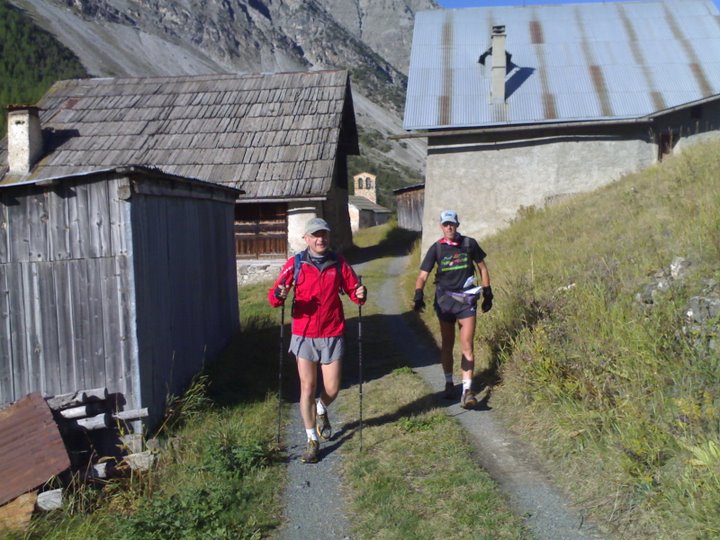
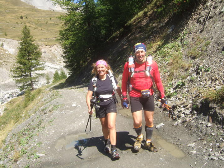
Nathalie and Antoine coming down the road:
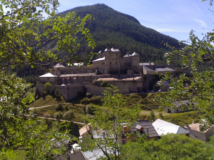
The switchbacks down toward the chateau were as steep and unending as I had remembered. I did all my usual knee pain-prevention techniques, and my knees seemed to be holding up OK. When I could see the chateau through the trees I knew I was getting close to the bottom.
Then I reached the pavement and the knee pain started for real. Luckily it wasn't much of a drop to the ravito, but I sure felt every step of it. Laurent "whooped!" his way down the road behind me, passing me going into the ravito. It was good to be there, and they had dates on offer - yum!
I did the usual stuff, thanked everyone, and then walked across the river to start the next climb toward the Col de Fromage. It was a long ways up, covering more than one length-wise page of map, but gaining "only" 1000 meters so that made it mostly gentle.
However, I was prepared for the "straight up" part that came first, right out of the gates. It was still a bit of a shock to the system after such a long downhill, but my body adjusted quickly. Not long later, as I was prepping my iPod, John strode up to me and we exchanged our usual happy greetings before he continued his speedy upward journey.
Coming off a road section, I missed an upward bend in the trail and instead crossed a little creek. I got suspicious immediately, as I thought the trail stayed on the left side of the creek until much higher up. I spent a couple minutes figuring it out but then corrected my mistake. I believe at least one other runner explored this area by accident too.
I got into a climbing groove, enjoying Pavarotti and several Mozart pieces. It was the calmer "second movement" portion of my playlist. When I stopped to drink my SPIZ, I noticed a couple runners coming up behind me; I believe they were Rodolphe and Vincent from group 2. I smiled and then took off up the hill, having moved on to Collective Soul. I heard them discussing something that I guessed was related to my pace.
As much as I was enjoying the power-walking upwards toward the col, my legs started giving me a gentle nudge, saying that if I could just dial it back half a notch, that would be great. They wanted to be ready for the next day, and the one after that, and now that my lungs had adapted so well, it was time to take care of the legs.
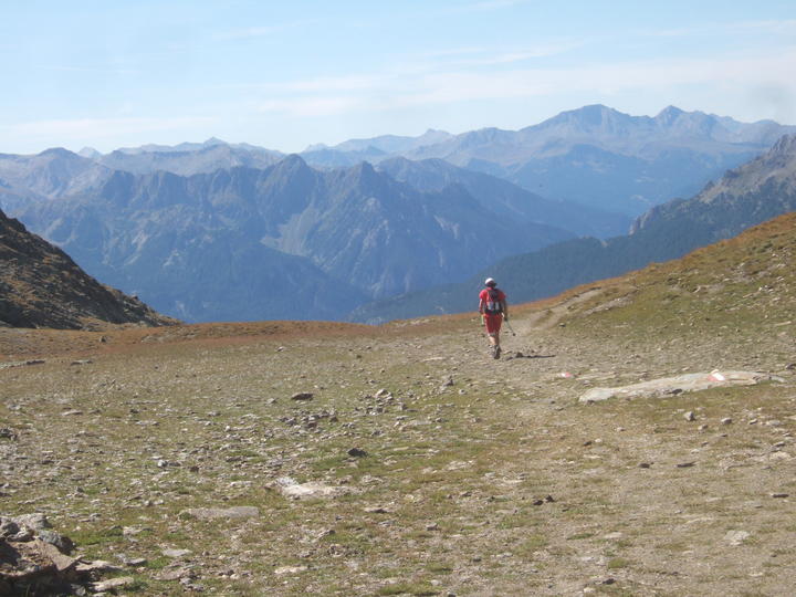
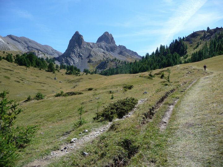
So I listened and adjusted, but still remained ahead of my compatriots. Coming back up above treeline, the scenery was splendid and worth pausing to gawk at.
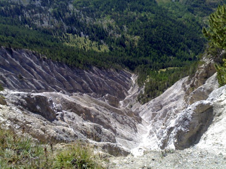
I was careful to follow the trail markers, knowing that a couple of the turns could be tricky if you aren't watching. No problems this year. I made the S-turn and followed the trail above this really neat ravine:
There was still more than 1.5 km to go to the col, and it was along a traverse that seemed to take a long time because the col looked so close to start with. This didn't bother me; I had come back around to Anastacia's music, so I was very happy. Good luck keeping up with that, you guys!
"When you're climbing up that mountain
It's so easy to forget
It's one step at a time"
At the col I found a huge group of cyclists - how did y'all get up here? The coolest part was that they had turned themselves into a cheering squad, and a very active one at that! They read my name off my race number so they could encourage me personally. Awesome. I had a brief question about exactly where to head down the other side, and they all chimed in to point the way. That made me smile for the rest of the run.
I tried to run smoothly down the rocky switchbacks. The terrain was fairly easy on my knees so I bopped and sang my way down to the road. I got an odd look from a local, which didn't surprise me and didn't slow me down. I could see the finish town of Ceillac and I was on a mission to get there.
I passed a huge group of tourists just as I reached a large cross at a bend in the road. They were discussing which way to go, and although I had the notion that I should probably pull out my map, instead I decided to make like I knew what I was doing and jumped onto a trail heading downward. I was rewarded for my folly with a red/white GR5 marking on a rock. Yay!
This trail led down to a lower road, and GTA markings led into town and to the Gite des Balladins. I was pretty excited that no one after John had passed me before the finish. And with that, I declared 100% success on Goal #3 (finishing this day with no major problems). Next up...
Goal #4 = Finish day 12.
Pretty straightforward! But this is what I had failed at in 2006, so I was understandably worried about this one.
Meanwhile, I enjoyed sitting, eating, and talking with everyone who finished stage 9 soon afterwards.
John finished 7 minutes behind Laurent and he was quite pleased with that. I gained over an hour on Sylvie, which astonished me. I knew I would be OK if I started in the second group, but Philippe still wasn't asking me to switch, so I didn't.
Jean-Paul C from Belgium decided to stop during this stage, after trying to come back from some issues but not succeeding. Antoine and Nathalie took a while to finish, coming into the gite during dinner to a big ovation. Philippe and Gilles worked over the maps, coming up with a day 10 variant (noooooo!) that actually turned out to be reasonable (oh! Well, OK then).
Results:
John = 5:27:50 / 2nd among full-course runners (overall placing = 2nd)
Marcy = 7:25:55 / 10th among full-course runners (overall placing = 10th)