Too Cool Big Chill 2011 Race Report
January 22, 2011Bastrop, Texas
by Kipley Fiebig
(Photographs with a watermark are courtesy of bobcat13 photography)
|
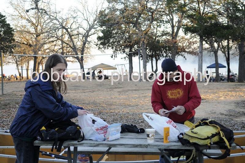
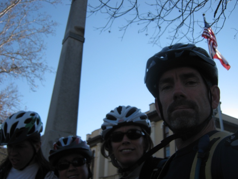
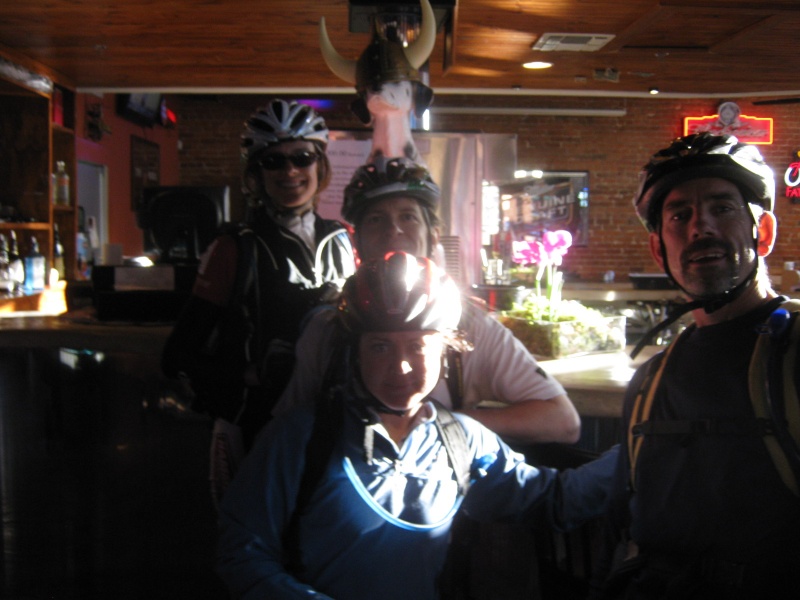
Our team for the Big Chill was originally going to be David Bogle, John Beard, Kristi Darby, and myself. But Dave came down with the flu leading up to the race. We didn't know of any strong racers that were still free at such short notice, so Dave said he'd still do the race even though he was in recovery. On Friday I told Dave not to bother if he still felt miserable. We awoke early on race day morning, and sure enough, Dave was still suffering. He called me to let me know of his poor condition and said he was still willing to race so as not to let us down, but I told him to go back to bed, as there would always be other races. No need to destroy yourself for a sport that's supposed to be fun! So John, Kristi, and I met in Bastrop and started discussing the adjustments we'd need to make to compete as a three-person team. I'd brought along both of my canoes since they'd already been loaded on the van, but if it was just three of us it made more sense to install a makeshift middle seat and just paddle with our entire team in one boat. Team iMoat heard that we had a nice lightweight boat that we wouldn't be using, so they asked if they could borrow it instead of one of their heavy boats, and in exchange they'd lend us a nice molded plastic middle seat that slid into our team's canoe. Well, that seemed like a fair enough trade to us, so we agreed. That's one of the great things about this sport... even though we expected iMoat would be one of the teams that would be fiercely competitive against us once the race started, we were still friends and didn't mind helping each other out like this. We started getting ready, finding a PFD to borrow for Kristi since Dave wasn't there to lend her one of his as originally planned. Then we heard from somebody who knew we were down a teammate that Sarah Stewart was going to be doing the sprint race as a solo team, but she might be willing to join us for the longer race. Well, it's always desirable to race as a 4-person team, since that's the "premiere" category and the one that makes you eligible for the best prizes. But none of us really knew anything about Sarah, or how strong she was as a racer. Robyn Cantor, Too Cool's co-race director, vouched for Sarah and said she was fast and full of energy. So we debated whether it was worth the risk of letting an unknown racer join our squad at the last minute. Would we get along? Would she slow us down too much? Well, the only way we'd even have a chance of winning the free shoes for first place would be if we raced as a four-person team. And we really like free shoes, so... we decided to give Sarah a shot. But first we had to track her down, since she was signed up to do the shorter race which didn't start until an hour after the long race, and so she wasn't even onsite. But she hurried back when she heard we'd like to race with her, and we did the quick introduction thing and then started adjusting our setup yet again to accommodate our newest teammate. We had to steal our second boat back from iMoat, with apologies. Then naturally Sarah didn't have all the gear and food that she needed for the longer race since she'd only been expecting to do the sprint, so we ran about to procure as much of that as we could before the race start. Speaking of the race start... we didn't have much time left! Our TA wasn't nearly as setup and organized as we'd like, so we were kind of running around with our heads cut off in the minutes leading up to the start.
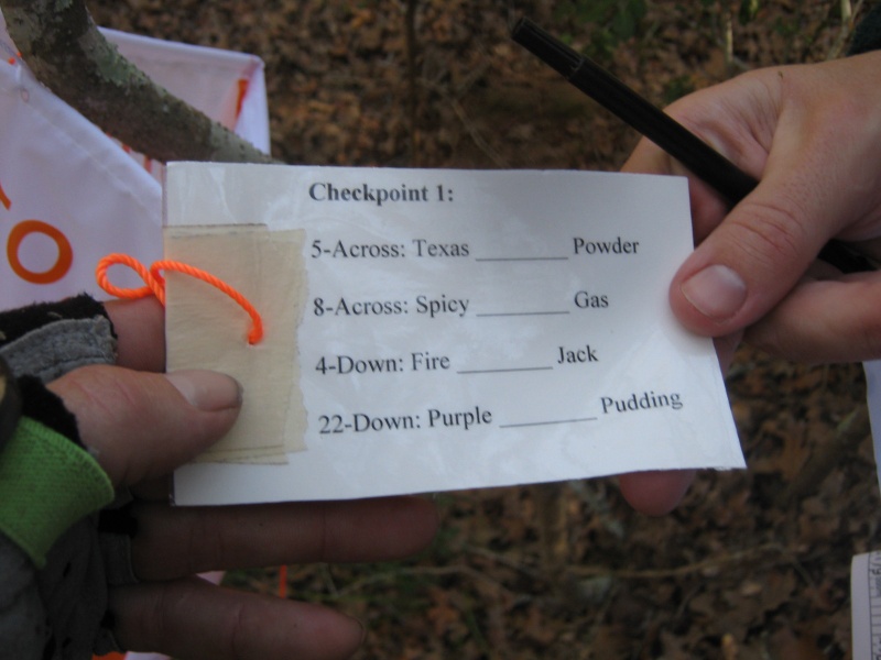
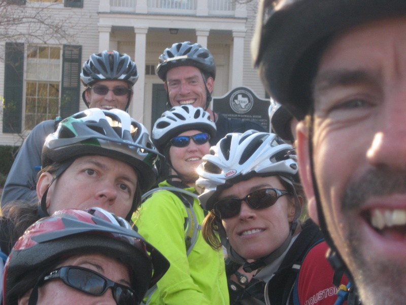
And oh yeah, we still had to do check-in for our team! Other teams were already getting onto the buses that would drive everyone to the starting line, and we were still at the check-in table, explaining our new team roster. It was pretty nuts. Usually we're all setup well before the race with plenty of time to spare because we don't like to be stressing out from the time pressure... but today we weren't nearly that organized! Fortunately the buses departed slightly behind schedule, or we wouldn't have made it on. We found seats on one of the buses and finally had a bit of relaxed time to actually talk to Sarah during the drive to the start. Sarah asked us how our team thought we'd do at the event and we said that we'd won this same race before, and could possibly win it again this time, though there were a couple of other strong teams out there that also had a legitimate shot at first place. Sarah was excited to hear that we might be able to win it, and so we agreed to push the pace and see what happened. The buses drove us to Rocky Hill Ranch, where we'd pre-staged our mountain bikes earlier. (All except for Sarah's bike, which we brought along on the bus with us. The race directors graciously allowed us to bring Sarah's bike on the bus to help us with her last-minute switch from a sprint course to the long course.) We exited the bus and huddled in the cold waiting for the start. We figured the race would likely start with a relatively short running leg, so we'd left the bulk of our food and water with our bikes for later, and were carrying hardly anything in our packs besides the mandatory gear. They handed out maps and instruction sheets, counted down to the start, and the race was on. Sure enough, the first leg was a trek, to find several points in Rocky Hill Ranch. We found a piece of flat metal sheeting to lay our map on and plotted out the 8 points. We'd be running all over the ranch, but it was still cold so we figured we didn't need much water. So we took off running north, following team Werewolves who'd finished plotting just ahead of us. Our first point would be #4, which was on a hilltop. Since most of the boundary fences of Rocky Hill Ranch didn't show up on the main topo map I wasn't sure if #4 would be on the east fenceline trail, or located farther inside the ranch. I couldn't quite figure out where the fence would be on the map while we were moving, but I guessed the point would be located off the trail as otherwise it would be too easy. I was actually content just to skip this point and get it on the way back when I would (presumably) have figured out the map better, when my teammates pointed out that we were walking past a hanging checkpoint flag, and should we check it out? Why yes, yes we should... and sure enough, it was #4. Well, at least now I knew where we were on the map, and where the east fenceline was on the map, to boot! John took much longer to punch the checkpoint than usual, and eventually I realized it wasn't just because the Werewolves were at the point at the same time... it was because you had to do more than just punch these checkpoints. There were clues hanging on each point that we had to solve, as well! Each point had several "before and after" type clues, where you had to figure out the words that filled in the blanks. The correct words would make a two-word phrase with both of the surrounding words. For example, for this checkpoint:
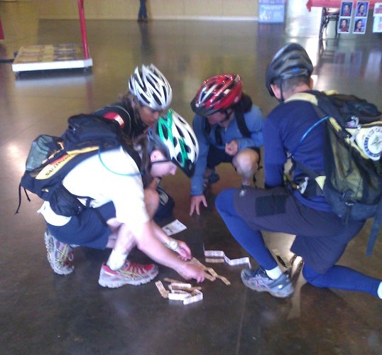
The four blanks should be filled with the answers of "chili", "mustard", "cracker", and "plum". And then each of those answers filled into a crossword grid. Pretty neat stuff. We wrote down the answers for the ones that came to our heads immediately, and took pictures and scribbled notes for the rest, and solved them as we walked. It worked pretty well... we figured out about half of the answers right at the checkpoints, and then the rest of the answers usually came to us a couple minutes later as we were walking away. All four of us contributed about equally to solving them, which was a nice balance. We hit the fence corner, traveled east a ways, then got on a trail north towards #8. The trail disappeared when we hit a section where all the trees had been bulldozed over, but we kept going north until we found the draw with the checkpoint. By this time we'd left all the other teams behind, so we quickly took notes about the clue words and headed out of there before anyone else could use our presence to guide them to the point. North along the eastern fence line to #2. We knew it would be hard to miss as it was just past the huge set of powerlines that cuts through the park, so we ran the whole way, determined to leave everyone else farther behind. We scooted up to the draw to get #2 then continued north some more. We eventually cut inwards away from the fenceline, and onto a dirt road that led to the draw for #7. From here we traveled west up to a hilltop for #5. #5 was the farthest point out, so we double-checked our punches to make sure we hadn't accidentally left anything behind and started back south. #6 was back under the huge powerline, in a draw. It was also near a water stop on the bike trail, so we took the opportunity to grab a quick drink as none of us had much (or any) water in our packs. #3 was at a draw intersection, and was slightly tricky because there were a lot of draws in the area. We pretty much went directly to it but by the time we found it we were relieved to confirm that we hadn't accidentally passed it. From #3 it was a long run back towards the next point, so we made our way over to the western fenceline and ran down the nice trail. #1 turned out to be the only difficult point for us to find... it was in a draw in an area where there were a lot of converging draws (some of which didn't show up distinctly on the topo map), so we had to keep exploring up each draw intersection until John found it. But that was pretty much the only "wandering around nav" we'd had to do so far, so we were happy about finishing the leg cleanly. Well, almost cleanly. With all the confusion at the initial checkpoint, when we'd reached the point at the same time as the Werewolves and we were learning we had to write down all the clue information, we'd actually forgotten to punch our passport at #4. It wasn't a big deal, because our return route passed by fairly close to #4 on our way out, anyways (the ranch is really narrow near the entrance). But it did mean we had to climb back up some unnecessary elevation gain to get back to the hilltop for #4. Well, at least we'd only forgotten to punch one checkpoint, and we were able to get it on our return trip... it would have been a much bigger disaster if we'd forgotten to punch one of the checkpoints farther out! We ran back to our bikes and were happy to see that we were the first team done, despite having to visit #4 twice. The volunteer gave us the instructions for the next leg. Here we were given one more set of before and after clues. And when we solved those three words, we had to subtract the letters that made up the answers from the letters that were circled in the crossword grid, and there was a single letter left over. This leftover letter corresponded to one of three different UTM plots, which was the location of the next point we had to bike to. That was a very neat way to ensure we'd solved all the clues on the course, as with this system the volunteer didn't even have to check our crossword grid! We figured out that the plot we wanted to bike to was "C", and so we grabbed our bikes and headed off. We could see the Werewolves jogging towards the bike drop as we were biking out, but at least we'd had some time alone to solve the final puzzle without having to worry about accidentally giving away the answer to them. We biked into Buescher State Park along the connecting road that led to Bastrop State Park. The road came near a pipeline that went closer to point #9. We considered following the pipeline trail to the point, but decided that might be too risky if the trail turned bad for biking, so we stuck to the paved road, which went almost parallel to the pipeline. Eventually John called out the spot where we'd need to drop our bikes by the road, and we set off on foot to the north towards the point. Unfortunately, the vegetation was pretty nasty in this area so it was slow going. It was only 100 meters to get back to the pipeline, but it took us a while to fight our way through. Then we had to fight through a bit more stuff north of the pipeline to get to the point in the draw. We started back towards our bikes, and John heard another team on the pipeline. We briefly considered trying sneak past the other team so as not to give away the checkpoint position. The problem was, the easiest way back to our bikes involved going right by the other team... to be stealthy we would have had to go through a lot more ugly vegetation. It wasn't worth being devious this early on in the race, so we just hopped out, waved to the other team (which was, not surprisingly, the Werewolves), and jogged back to our bikes. We biked up the road and came around a curve where the road hit the pipeline again. The Werewolves had taken their bikes with them along the pipeline trail, so they popped out on the road right ahead of us. Well, I guess that answered the question about whether following the pipeline the whole way would have been faster than the road. The Wolves had chosen better than us, this time! We biked with the Wolves for a bit until they started gradually pulling away from us on the uphills. Sarah was riding a bike with a heavy suspension, more suited to technical trails than for speeding along on roads. John hooked up a tow system to help Sarah along, and we continued chasing after the Wolves towards Bastrop State Park. We turned north off the park road onto Alum Creek Road, then west onto Gotier Trace road towards #10. At the side road which led off to #10 there was a volunteer sitting by the intersection, and she handed us instructions for the next bike points. She also told us we were the first team there... which was odd because we hadn't passed the Werewolves on the road. Oh, wait, there they were... they came biking up to the point from the other direction, having missed the Alum Creek Road shortcut to Gotier Trace. We'd chosen better than them, this time! We plotted the bike points on the map, and started down the old road to the old barn. We managed to run into the barn and punch #10 and get out of there before the Werewolves could see us. There was a long section of old trails and roads that led to the next couple of points. None of the trails were on the map, but Too Cool had been kind enough to put up orange flagging to guide us along. I was actually kind of disappointed that they flagged the trail, as I'd run along these trails (in the opposite direction) during a previous year's race, so pretty much knew where they went. But the flagging made things fair to those teams that didn't know about the trails, so I suppose that was for the best. We hit #11 at the edge of a pond. Then while we were doing a bike adjustment Werewolves showed up as well. We got back ahead of them and made it to the gate at #12. Then it was time to leave the dirt paths of the park and cross over to nice paved roads that went counter-clockwise around Lake Bastrop. We zipped along the roads, and I kept looking behind us, but I didn't see the Wolves or any other teams following us anymore, so that was something. We almost turned into the wrong park, but fortunately realized that we were looking for the North Shore Park in time to prevent that mistake. Posted at the trailhead in North Shore Park was a large map of the bike trails, so we compared our topo map against that to get an idea where the points were. #13 was at a trail intersection near the start of the trails, which was no problem. We biked the curvy, sometimes hilly trail around the lake to #14, which would be on a bridge. We passed one bridge with a checkpoint, but it was the wrong one, so we kept going until we make it to the correct bridge. We weren't biking particularly fast, but we still managed to make it back to the TA at South Shore Park before anyone else. Yay! The next leg would be paddling. Since we'd been so rushed and disorganized that morning our boats weren't staged anywhere near the water, and we still had to track down a PFD for Sarah. We spotted a sprint team carrying their boat away from the lake and asked if we could take one of their PFDs (since it was a Too Cool PFD anyways), so we were set. There were three points on the lake, one to the north, one to the northeast, and one near the TA but around a peninsula to the southeast. Our transition was pretty slow since we were still suffering the effects from starting the race without time to properly arrange all our gear and such, so by the time we launched our boats the Werewolves had actually snuck by and got on the water ahead of us. We paddled north in pursuit of them. The Wolves were definitely paddling faster than us... our team sure missed Dave's strong paddling! But we were making decent enough progress, so we weren't too worried. We got #15 at the northern bridge. Then it was time to decide if we should go to the northeast point #17, or just skip it. Each team was allowed to skip one checkpoint in the race with no penalty. But you had to decide for yourself which was the best point for you to skip. We didn't know what the rest of the course looked like, so we would be making the decision with incomplete information. But since we were paddling slower than our competition, and we knew the wind was from the south and due to get stronger over the next hour, we decided to gamble and use our skip right now on the paddle. We saw Werewolves turn east towards #17, and so our paths diverged. Who was making the better decision this time, we wondered? We were paddling into a headwind all the way back south on the lake, but it wasn't too bad. Not nearly as bad as some previous years on this lake, that's for sure! We were never in danger of capsizing and the waves never came up into the boats. We made it to the south inlet for #16, got it and headed back towards TA. Along the way we passed iMoat on their way to #16. They were actually getting #16 first, so they were still quite a long ways behind us as they still had to do the main paddle all across the lake. We exchanged friendly greetings and headed into the TA. As we were taking our boats out of the water team Ike's Revenge was just getting ready to put theirs in. So I took the opportunity to give Scottie Trevino a quick hug and wished her team good luck. The next leg was a quick trek along the south side of the lake to three points. They were all close by so we decided to travel light again and not take much water. We headed onto the peninsula to the east and through the campgrounds to the northern tip for #18. Our route there involved some bushwhacking, but we found a much better clear path out back to the southern tip of the lake, where we found #20 in a draw. Then it was around to the southeast side of the lake, where we'd never trekked before. We followed a trail along the lake edge that seemed to be heading right towards the point, but then the trail turned away. We decided to continue directly towards the point and hope it wasn't too nasty. Bleah, it turned out to be extremely nasty... so it was a very slow 400 meters or so through thick brush to get to #19. We got lots of legs scratches there. And, of course, once we made it to #19 we found that there was a beautiful trail that led directly out, that went parallel to the route we'd taken in. Sigh. We didn't see any teams on our jog back to TA, but we were certain that the Werewolves were already out on that trek, and that we'd just missed them on the way back. The next leg would be biking again, this time to downtown Bastrop. We had to find a bunch of specific businesses downtown and take our pictures at them. Plotting the businesses on the map was tricky since we weren't given the usual UTM coordinates; instead we had to figure it out from various maps, pamphlets, and educated guessing. At least Bastrop was a small town... you couldn't mess any of it up too bad! As we were about to take off I noticed that my front bike tire had gone flat. Well, it had still had air at the end of the first bike leg, so maybe it was just a slow leak. John ran to retrieve his bike pump from his vehicle (there's our disorganized TA slowing us down, again!), and we pumped up the tire. We couldn't hear any obvious air leaking, so we decided to risk it and try to do the leg without changing the tube. We could always stop to change the tube mid-leg if we needed to, but since it was such a short leg, and all on pavement, we figured there was a chance we wouldn't need to. We took Hoffman Road over to Bastrop and then to a bridge to punch #21. Then it was time for the urban points. Our first stop was the Chestnut Family Entertainment Center for #29. Here we had to go inside and win 100 tickets on the various arcade games they had. We decided it would probably be quicker to just buy the tickets off of folks who were already playing the games. Since the tickets were pretty much worthless, most everybody was quite happy to sell them to us, so soon we had collected enough. Here we are counting our tickets to make sure we had 100:
Despite the fact that we should have jumped ahead of them when we skipped the paddle point, the Werewolves caught up to us at this spot and they were collecting tickets right alongside us. Uh oh, this isn't good... since they (presumably) still had their skip point to use later, that meant they were actually ahead of us right now. Well, there was nothing we could do about that now other than keep on racing. #25 was the Bastrop County Court House, where we took this picture:
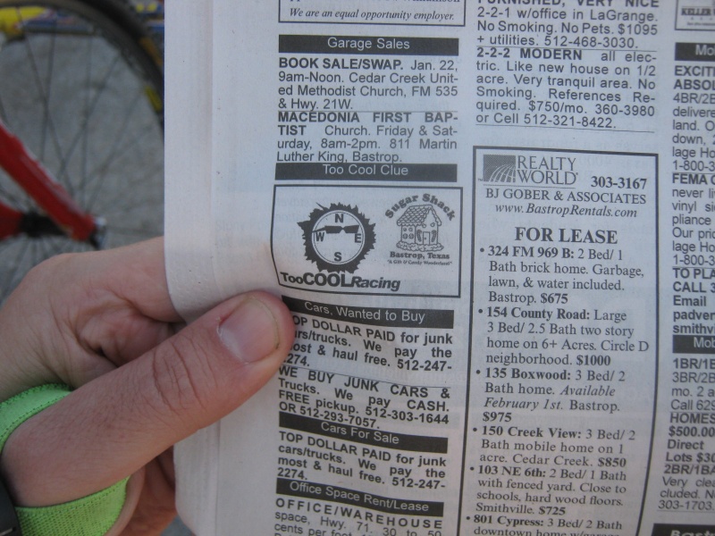
We got lucky on the next one. We'd mapped out all the points we had to visit downtown, except one. We needed to find a local newspaper for #22, and get a picture of the Too Cool advertisement within. We had no plan on where we were going to get this paper, so when we saw the Werewolves stop right in front of us at a paper vending kiosk, well naturally we followed their lead and bought our own copy of the paper there as well:
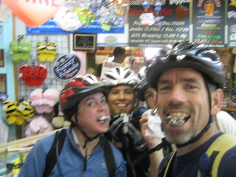
We biked over the bridge to the Sugar Shack while the Werewolves decided to go off to get some other checkpoint first. At the Sugar Shack they gave us all sweet candy treats and we had to take a picture with all of us eating them. And man, they tasted good! This is our type of mid-race special test, right here:
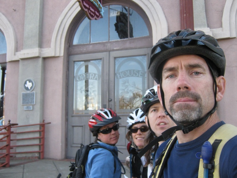
Back across the bridge, then a block north on Main Street to #24, the Bastrop Opera House. We circled the area a bit before we found it, tucked in between some of the other downtown businesses:
We figured the next two points would be further north on Main Street. But, the street numbers in the area were higher than what we guessed they'd be, so we turned around and went south. No big deal, as Bastrop is so small it's hard to mess up too bad. Especially when you're on bikes. At 933 Main Street we found this pub where we had to go inside and get our picture with the stuffed dog for #26:
Then at 702 Main Street we had to take our picture in front of the Army Tannery for #28. Not sure what a tannery is, as we didn't bother to stick around to read the sign:
Ok, one last downtown point. North again on Main Street, then a bit west, then a bit north, to the Crocheron-McDowall House for #27. We hadn't seen Werewolves since the newspaper kiosk, so they'd been traveling through Bastrop in some other order, but they caught up to us at this point. So we got this photo with eight (count 'em) adventure racers all in it together!
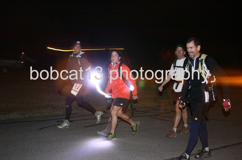
Well, that was a fun, fast urban scavenger hunt! We headed back east out of Bastrop on Hoffman Road again. There's a lot more uphills on the way back, which I struggled with as my legs were getting tired. At least my front tire held enough air until the leg was all over, we were certainly thankful for that. Back in TA we received the final leg, and to nobody's surprise it was a trekking leg through Bastrop State Park. We started collecting lights. Sarah naturally didn't have a headlamp since she'd been only been planning on doing the shorter race, but between our spare team headlamp and a bike light we managed to scrounge up enough for everyone. We headed south toward the park in the lead, but we knew the Werewolves would be right behind us. We also knew that with their unused skip point, we wouldn't have much chance of staying ahead of them. For almost any other team, we would still have some hope that we could out-navigate them enough on the final leg that we could overcome our one checkpoint disadvantage, but the Werewolves weren't the type to make many nav mistakes. So we certainly didn't expect to be able to get the remaining seven checkpoints in the time it would take them to get six. What's more, I was starting to feel a bit sluggish, so I was holding our team back from running the whole way. We would run for a bit, and then I'd request that we walk on anything resembling an uphill. And sometimes even if the terrain was flat, I'd walk that too. We crossed the highway and jumped the fence into Bastrop State Park. We traveled down a draw to find #35. No problemo, one down, six to go. We continued south through a gully, hit the park road and took it around towards #30. There were a couple of similar draws in the area, so I took some time to make sure we were heading up the correct one, and then we traveled right up to it. On the way back down we came across the Wolves heading up to it, so they were only a minute behind us at this point. Our two teams had been leapfrogging back and forth All Day Long! I could tell from the map that #31 was going to be tricky. First off the clue for it was "Hillside", which meant that it wouldn't be on a precise land feature. And there weren't any park trails that went anywhere near it. And it was in a confusing area, contour-wise and draw-wise. I pondered the best way to approach it, and decided to come at it from the south. This wasn't ideal from an efficiency standpoint, because it meant we would have to climb up to the top of a large hill before coming back down again to the point. But it was good from an accuracy standpoint, because once we were up on the hill we'd know exactly where we were on the map and we'd be at a good spot to drop down right onto the point. So we climbed up, up, up... that's a lot of contour lines we were crossing! Finally we made it to the top, and traveled across the plateau to the northern edge. Then down, down, and a little to the right, and... checkpoint! Yay, I was glad we got that one on the first try, as I didn't want to have to wander around this area in the dark forever trying to find it. We headed east to find the park road, then south to find the trailhead. Then east along the trail up another long hill. Up, up, up. When the trail turned north we left the trail and continued east to the park border. It consisted of an old fence in some parts, and sometimes only flagging in parts where the fence had disappeared completely. There wasn't any trail along the border, but we were able to follow the flagging well enough, and so we pushed our way forward through the brush. Finally we made it down to a draw, for #32. We figured that this was the checkpoint that Werewolves would skip, as it was the farthest one away. And it had taken us quite a while to get there, as we had to go cross-country for most of it. Oh, well. We cut northwest from there until we hit the old dirt road that took us north. It ended at the main park road, which we crossed and headed over the gravel pit. Then northeast, down, down, down, bottom out at a drainage, climb up the other side, head down into another drainage, and then travel up the drainage to #33. Checkpoint! Well, we might not have been moving too fast anymore, but at least we were still hitting all the points dead on. And in the darkness of night in Bastrop State Park, that certainly counts for something. Back up to the road. After a brief travel along the road, jump off and down into another draw. Down, down... and, checkpoint again, #34. Yay. From here we had a choice... we could either take a direct route northwest to get us back to the road that went back to the TA. Or we could take a roundabout route to the south that would get us on roads and take us around the tiny camp lake. The roundabout route was longer, obviously, but we figured it would be a lot faster to travel on roads instead of doing yet more bushwhacking, so that's what we did. And it was nice to be able to turn our "nav brains" off for a bit once we got on the roads. We exited the park and headed back on the road towards TA. I was finally feeling a bit better so we were moving ok, but we still didn't see any reason to run really fast. We figured the Wolves were way ahead of us and that we couldn't catch them even if we ran all out. And we didn't figure that there were any teams behind us who could catch up to us, as our nav during the last leg had been spot on. So we figured our position in second place was secure. As we got closer to TA we started seeing other teams going up and down the road, either on the earlier bike leg or just starting out on this trekking leg. We exchanged greetings and encouragement and tried not to accidentally blind each other with our lights. As we got closer to TA we started asking teams coming out if the Werewolves had finished yet. Everyone we encountered said they didn't think so or that they didn't know, so we started wondering if we could actually be in the lead. But we didn't really believe it. The race photographer was stationed a couple hundred meters from TA and he took our picture as we walked in. We asked him if anyone else had finished, and he said he didn't think so. Huh. Maybe we should be moving faster, after all...
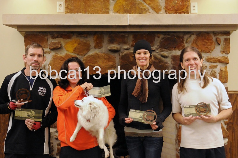
We still did have one last point to get... the final point on this trekking leg was 600 meters north of the TA. We briefly considered going into the TA building to check and see if the Werewolves had finished or not, and then decided that that was a silly idea... either they had or they hadn't. No sense wasting time checking, as either way we still needed to get this last point. Sarah picked up her dog from TA to take along with us for the last point, since she'd left it alone for much longer than originally planned, and the five of us headed up the trail. I had guessed that this point would be on one of the side trails that branched east off the main trail, but as we checked them out they all branched off too early, as they were south of a lake inlet we had to get around. So we went back to the main trail and followed it north around the water. I still thought that it might be off to the east of us... but, nope: #36 was at a bridge right on the main trail. So, that was that, time to head back. We debated whether it was possible that the Wolves might have gotten #36 first on this leg, so that they could be approaching the finish line from the opposite direction with no more points to get. If that was the case... obviously we should be running all out to try and beat them! But we decided that there was no way they could have gotten #36 first, since we started the trekking leg before them and then they'd caught up to us and the second point we were at. Even if they were moving faster than us, there was no way they could have gotten three points in the time in took us to get two. But we still jogged in anyways, just in case we were wrong about something... We entered the building to finish the race, and... We were the first team back! Woohoo! We found out after the race that Werewolves had a ton of trouble trying to locate the tricky hillside point, #31. They had approached it from several different directions and they still couldn't find it, so they had to use it as their skip point. So they couldn't skip the far point #32, which would have been more ideal. Well, after spending all day racing head-to-head against them, it all came down to that one point, then. Today was just our day to get lucky with the nav.
Despite their problem the Werewolves managed to hold on to second place, and iMoat took third. Thanks to my teammates for being so strong during this race, and for being so fun and in such consistent good spirits even as we were battling the Wolves the whole time. And a special thanks to Sarah for taking a chance on racing with us at the very last minute and gamely adjusting to doing a much longer race than planned! That's the spirit of adventure-racer flexibility, right there! And since we managed to get a four person team across the line first... Yay for free shoes!
|