Too Cool Mighty San Gabriel 2011 Race Report
April 16, 2011Georgetown, Texas
by Kipley Fiebig
|
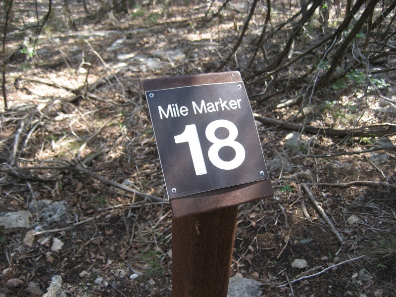
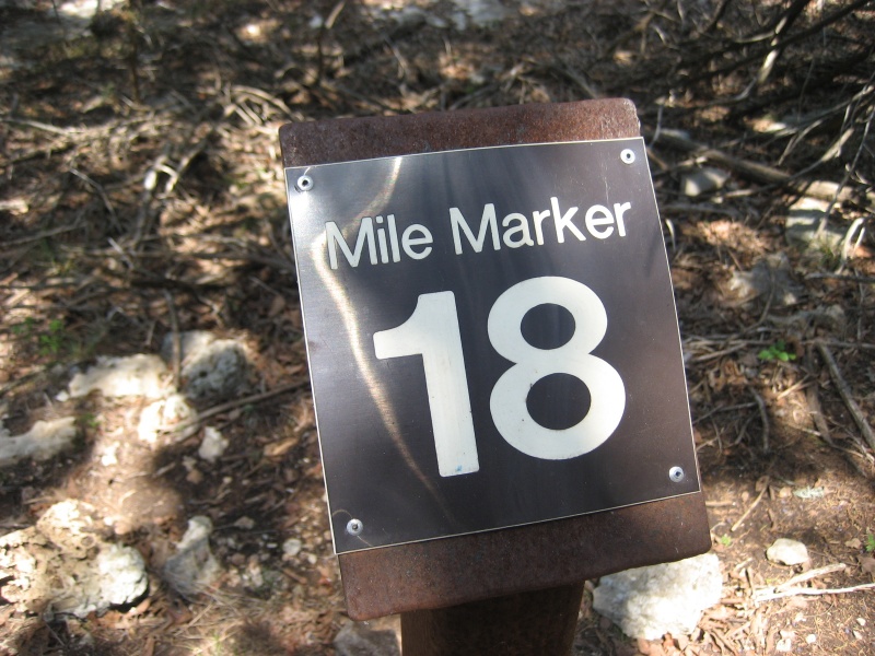
Too Cool racing hosted their annual "Mighty San Gabriel" adventure race at Lake Georgetown, where teams could chose from either the 12 hour race or the shorter sprint length course. Our team of David Bogle, Jason Mittman, Julie Standing, and me signed up for the long course. Part of the reason we love this race is because it's so close to Austin, which admittedly gives us a bit of a home-field advantage. The race started with all the teams simultaneously opening an instruction sheet, which told us we had to run around Russell Park to pick up three items. We were also given an aerial map of the park that marked the item locations, which we could get in any order. Even though we didn't yet know exactly where we were going, we immediately started running up the road out of the TA (Transition Area), analyzing the map and instructions as we ran. This "figure it out on the fly" strategy worked out well enough, and we decided to hit S3 first, which was at the small parking loop by the bike trailhead just off the park entrance. At S3 there were a whole bunch of numbered flags sticking out of the ground, and we had to find the one with our team number on it. Since we were the first team to arrive at this point (many other teams went to either S2 or S1 first), there were over 60 flags to search through... but we got lucky, as pretty much the first flag I looked at had our number on it. Score! We ran down the long hill to the swim beach to S1. Here we had to find a toy army man, which turned out to be buried somewhere in a patch of the beach that was marked by flags. We were just about to start digging when we spotted an army man that had already been dug up by a previous team, just lying on top of the sand. Good enough for us, we grabbed it and headed out of there. We cut off the roads for a more direct route around a couple of the inlets from the lake. We encountered some teams looking for the army men at the wrong beach, and we let them know that they'd find them if they kept heading back in the direction we'd just came. We did a short bushwhack up from the tip of the inlet to reach the road that led to TA, and then jumped off the road on the other side to do another short bushwhack down to the cove to find S2. S2 was similar to S3 in that there were a bunch of Easter eggs lying on the ground, and we had to find the one that had our team number on it. Once again, we got lucky, and the first egg I picked up was ours. Guess I should have bought a lottery ticket today. The Werewolves had gotten the first two points in the opposite order from us, but they were now right behind us at this point. We sprinted with our egg back to TA in first place, though there were many teams that were hot on our heals. The next set of instructions told us it was time to paddle. We quickly plotted the four points and headed down to our boats. We launched out onto the lake, with the Werewolves still close behind us. We paddled out of the cove by the TA, as Dave figured out an attack plan to visit the points. We paddled our boats west along the north shoreline, heading to CP 4. Fortunately, the wind was much calmer than last year's race on this lake, so it was smooth sailing (er, smooth paddling, that is). We docked our boats at the big draw leading up to CP 4, which would be in one of the reentrants that lead into the main draw. Dave expertly picked the correct reentrant on the first try, and so we were in and out of there nice and quickly. Some of the other reentrants were full of lots of nasty undergrowth, so we were glad that Dave had gotten it right! It looked like the Werewolves had decided to visit the paddle points in the opposite order, so at least we didn't have to worry about leading them to the checkpoints. We crossed the lake to the south shore for the farthest out point, CP 3. This was similar to the previous point in that it was in a reentrant leading into a main draw, and the trick once again would be figuring out the correct reentrant. This task was somewhat difficult as there were a lot of reentrants in the area, and it was hard to determine exactly which one you were looking at. And there was a lot of brush. Jason started heading up our first guess for the reentrant, and then he informed us that it split three ways. I told him if anything the point should be up the left branch... that is, if we were in the correct reentrant. And then Jason yelled back that he saw the checkpoint. Whew! We were glad to be out of there without having to waste a lot of time searching and fighting our way up and down the draw. On the paddle to CP 2 we passed by the Werewolves who were doing the loop in the opposite direction, and we gave out the "Werewolves Howl" to greet them. CP 2 was relatively easy, navigation wise, as it was in the middle of a nice big draw. As long as you didn't get confused about the splits and turns in the draw, you'd go right to it. And so we did, though there was a slight bit of brush we had to push through to get there. Another short paddle brought us to CP 1. This one would involve leaving our boats and trekking farther inland than the rest of the points. Many teams that had done the paddle loop in the other direction had already visited this point, or were still trekking about in the area. Dave took the lead on the navigation for this one, and Jason found it and punched it. Back to the boats, and time to paddle across the lake again back to TA. The race directors stated that we couldn't just leave our boats down on the shore beneath TA... we had to carry our boats up the steep hill to the TA at the end of the leg. Knowing this Dave suggested that we attempt a bushwhacking shortcut, and portage the boats up the south side of the TA peninsula. This would save us a bit of paddling around to get to the north side of the peninsula where we'd started. It was slightly risky, because we didn't know if we could find a decent route to carry the boats up the hill through the trees. But we knew that the trees didn't last very long before you hit the road, so we decided it was too cool of an idea to pass up. We docked on the peninsula just west of the cliffs, and started lugging our boats up the hill. Julie led the way and found us a great route through the trees. We had to turn the boats left and right a bit to get through, and watch our footing to avoid the cactus, but it worked. Soon enough we were on the road and jogging with our boats back to TA. We hadn't seen any other teams paddling back as we were finishing, so it looked like we'd banked a bit of a lead at this point. The next leg would be biking, on the trails around the lake, and then over the dam and along the river to Georgetown. We had to take pictures of specific mile markers along the way to show that we'd biked the correct route. For the first few miles the trails aren't the friendliest in the world... they're full of jutting rocks and tricky turns. But, at least they weren't wet and slippery like last year's race, so we made decent progress. Soon we'd reached our first bike CP, mile marker 18:
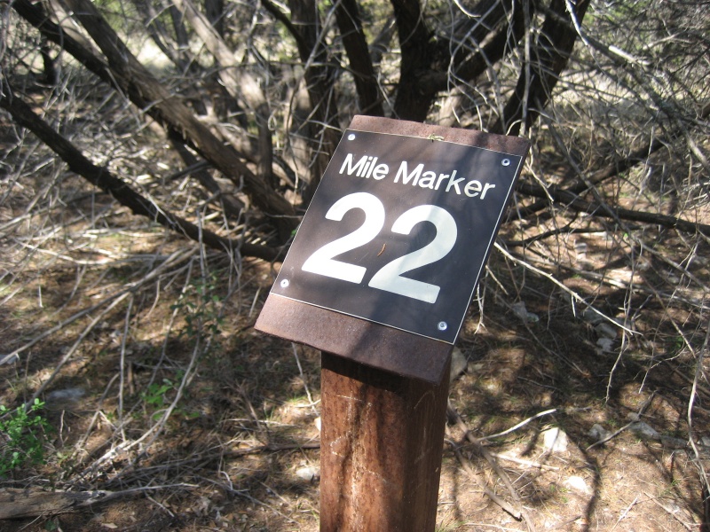
Then we crossed through Jim Hogg Park, and continued along the trail on the other side. Here the trail was slightly less rocky, but there were fewer trees to provide shade. Our next CP picture was of mile marker 22:
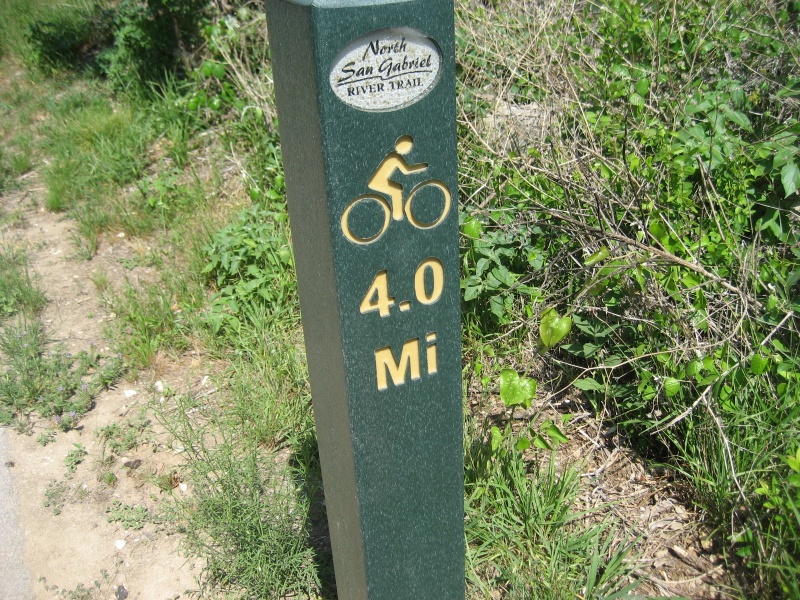
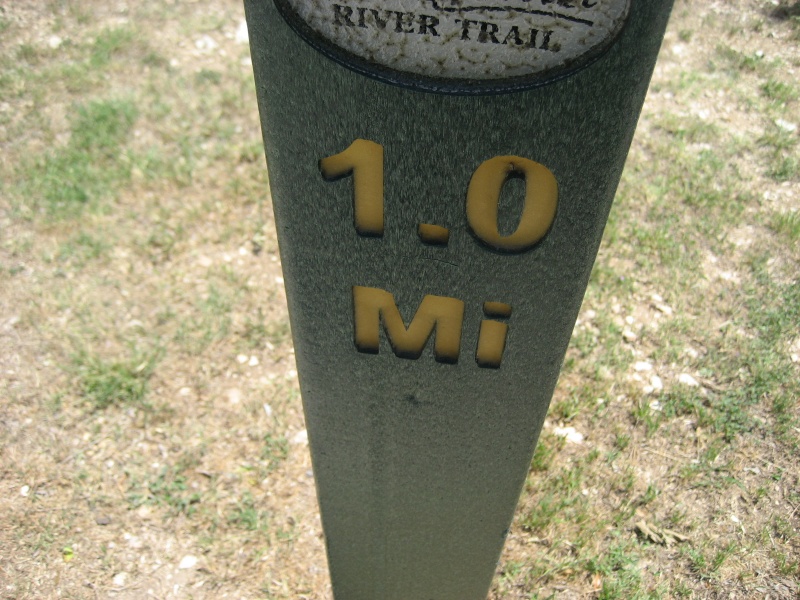
Shortly after that we were finished with the icky rocky trail, and we crossed over the dam. The trail on the other side of the dam is much nicer, as least to folks like me who aren't great mountain bikers. It was mostly paved, and flat, and since it was following the river downstream it was almost all downhill. So we flew down the trail, stopping only briefly along the way to get the remaining two required pictures at mile markers 4.0 and 2.1 (we switched trails after crossing over the dam, so these used a different reference point for their numbering system):
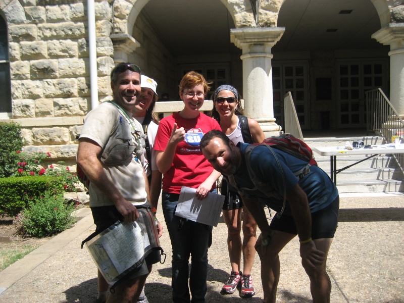
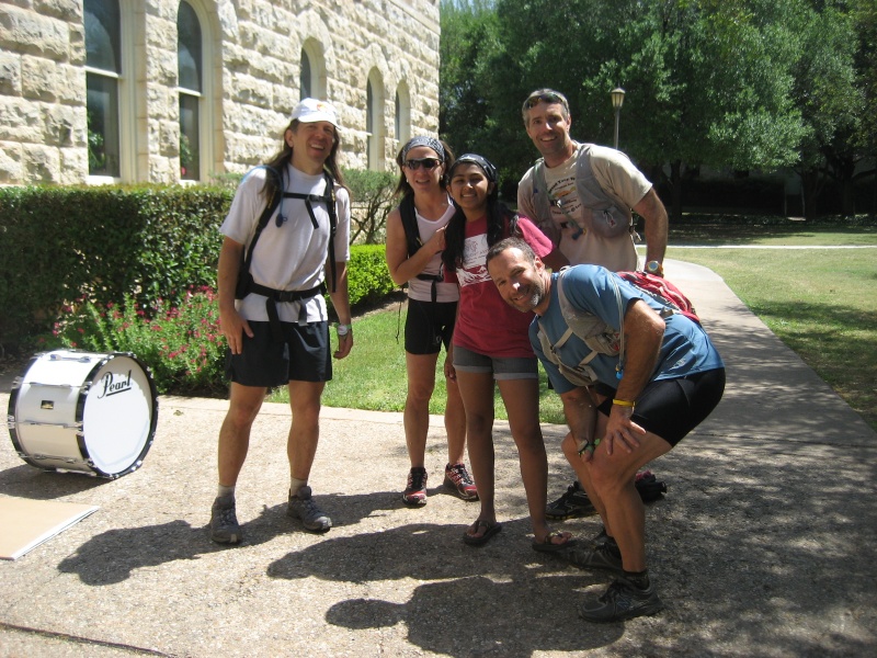
At the end of the trail we came to the bike drop, where a race volunteer handed us our next set of instructions. We would have to run around downtown Georgetown on foot, taking pictures of various items. Two of the checkpoints were at Southwestern University, and one was at the Harper-Cheshire house, which could be found on the map. We also had to find checkpoints at the visitor center and the library, which were not on the map... but we figured that Georgetown is so small, that we could probably just ask folks on the street and they'd be able to point out the way. The final downtown checkpoint was a bit of a scavenger hunt, in that we needed a picture of us with five different strangers wearing a red shirt. Well, the bike drop volunteer was wearing a red shirt, so we figured we might as well take advantage of that fact:
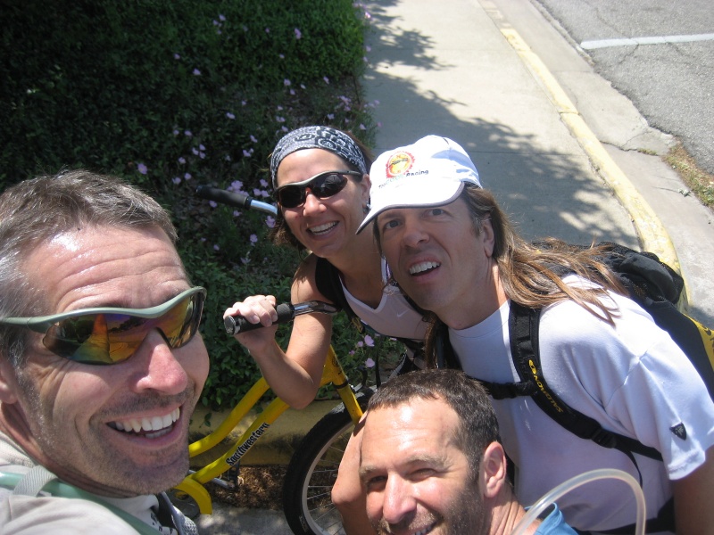
We had to cross the river to get out of the park. Annoyingly, the bridge on the trail over the river was barricaded, so we had to wade across the water. We started running south on Holly Street towards Southwestern University. I discovered that my new shoes I had bought just before this race were waterproof... which meant that they wouldn't drain the river water that was in them. Ugh, how unfortunate... I would have to drill some holes in these shoes if I wanted to use them for adventure racing again. But for now, there was nothing to do but suffer and deal with it. Kids: Be smarter than me... never wear waterproof shoes at an adventure race! At the university we had to find one of their yellow "Pirate" bikes and get a picture with it. We figured this might be tricky, but nope... pretty much as soon as we were on campus we started seeing these bikes sitting out everywhere:
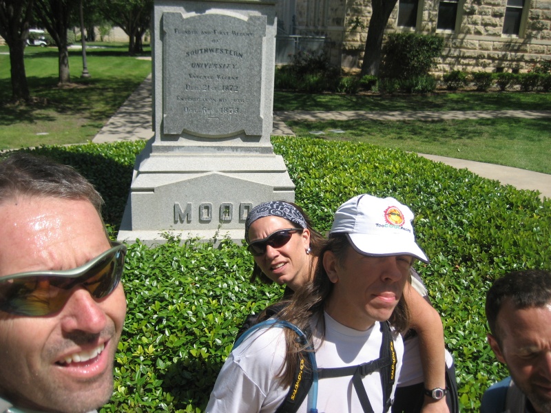
The other checkpoint on Southwestern University was for the "Mood statue". We started asking students about it as we ran by, and while they didn't know about the statue, they pointed out to us where the "Mood building" was. We figured the statue would likely be near the building so we ran that way. And sure enough, it was in the courtyard:
Near the statue there were two folks wearing red shirts, so Julie quickly convinced them to let us get a picture with them. That's three red shirt pictures down, and only two to go:
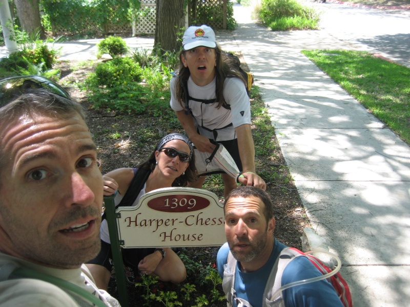
Next we headed west and south to the Harper-Cheshire House. Along the way we were continually asking random folks on the sidewalk if they knew where the library or visitor center was. Pretty much all of them agreed they were both near the center of town. At the house we got our picture in front of the sign:
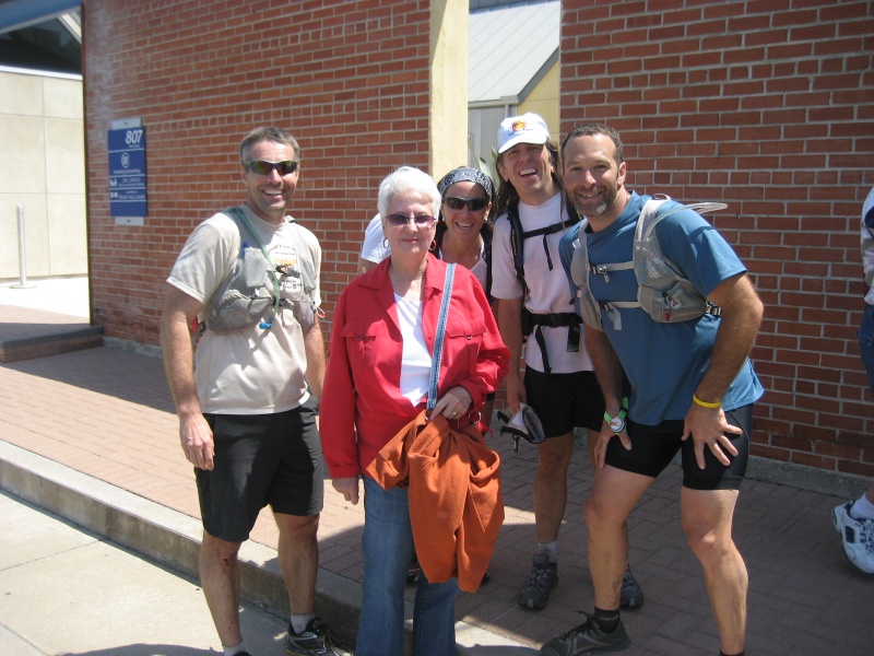
We made our way north and west towards the downtown square. There was a huge "poppy festival" going on, so the middle of town was blocked off to traffic and there were a ton of people walking about. People kept indicating we were getting closer and closer to the library, so that was a good sign. Right before the library we ran into two more people with red shirts:
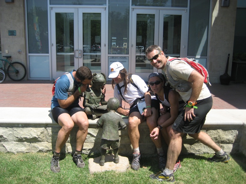
The final person that we asked "where's the library?" pointed at the building right next to us and said, "that's it!". Cool! We looked at the statues by the entrance, and the plaque for one of the statues indicated that it was the checkpoint we were looking for, called "Danielle's Dream":
On our way to the final checkpoint we came across yet another person wearing a red shirt. While we already had five red shirt pictures, we figured that it couldn't hurt to take one more just in case there were any problems with any of the others:
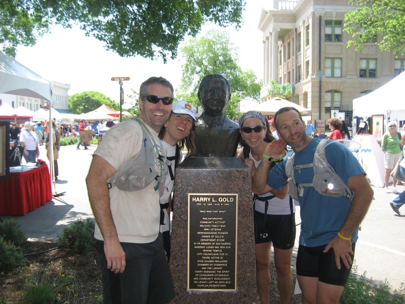
We headed into the chaos of the poppy festival and started searching for the visitors center. Jason found a cop that was able to point it out to us. Here we had to take a picture with the founder of Gold's Department Stores, who apparently was Harry L. Gold:
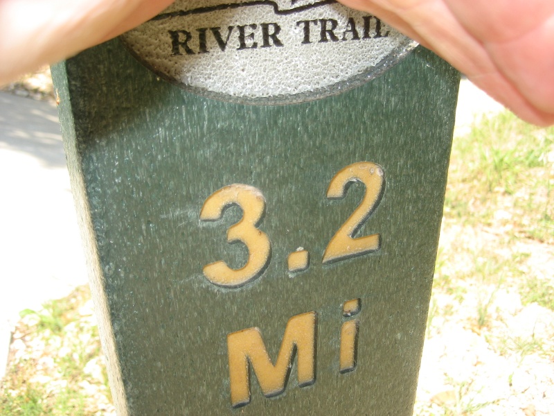
And... that was it. We ran north and east back towards our bikes, rereading the clue sheet as we went and confirming that we'd indeed gotten pictures of everything that we needed. By the time we arrived at our bikes there were a couple other teams' bikes lying there, but not many. The volunteer handed us instructions that had us biking back along the same trails to make our way back to TA, while taking pictures of different mile markers along the way. Since the bike back was pretty much all uphill, my three teammates took turns towing or pushing me along the nice flat trail. Thanks, teammates! Soon enough we'd reached mile 1.0, and then mile 3.2:
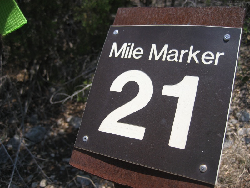
We walked up the steep hill to the dam (except Julie, who rode straight up it and said, "that wasn't that bad"!), and then it was time for the nasty rocky trails again. We were passing by a lot of teams that were biking in the other direction, all still heading out to the bike drop. It was starting to get warm by now, so this trail section (which didn't have much shade) was a bit brutal. But we made it through and got the picture at mile 21:
As we biked we discussed whether we should take a shortcut on roads from Jim Hogg Park to Russell Park. If we took the shortcut we would miss the final checkpoint on the trail. But according to the instruction sheet missing a checkpoint in this section would only be a half hour penalty, instead of the usual more severe penalty of moving you down in rank below any teams that got all the checkpoints. We debated whether we could bike around on the roads a half hour faster than taking the trail. It wasn't a clear-cut decision either way, but when we reached Jim Hogg Park we were all still handling the bumpy trails relatively well, so we decided to just go ahead and ride the trails back, as the course intended. The last picture was of the same mile marker that we started off on this whole bike thing, mile marker 18:
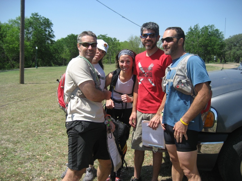
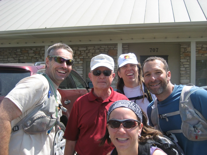
Bumpity, bumpity, bump... we slogged on along the trail. At various points some of us occasionally fell off our bikes, but nobody got banged up too terribly. Finally we broke out of the trail and onto the lovely paved road back to TA. Julie and I went to our transition spot to start refilling our water and refueling while Dave and Jason checked us in from the leg. Then we heard Dave and Jason yelling for us to come over and check in as well, so we ran over and regrouped. What was it, was there a special test that the whole team had to do? No... it turned out that that was all for the race... we had finished. That caught us by surprise, as we'd been expecting a final trekking navigation leg around the park, which is how Too Cool usually ends their races. But, we weren't complaining, as we'd finished earlier than expected, and hey, we'd won! The Werewolves came in shortly afterwards, followed by HFAR Masters of the Universe in third. Like us, they were all surprised the race was over already. But everyone was happy that the free beer (which the sprint teams get first crack at) hadn't run out yet! It was a most excellent day... a very fun race, with awesome teammates. We had gotten quite lucky this race, making pretty much no navigation errors. We had traveled directly towards our next needed point essentially 100% of the time, which is a quite rare occurrence for these events. Sometimes things just go your way, I guess. Here's a shot of us posing at the finish line. Julie had already left by this time, so Dave's wife Michelle is standing in for her:
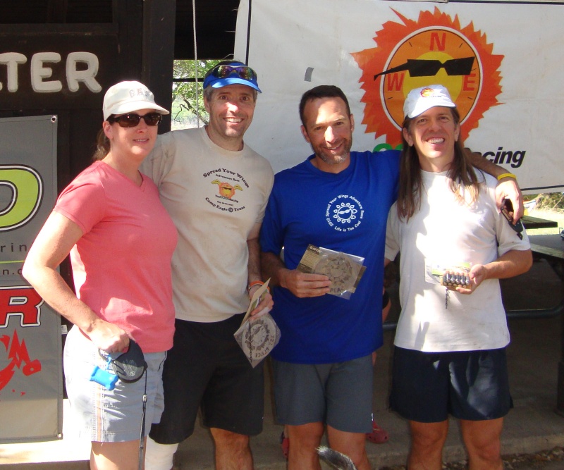
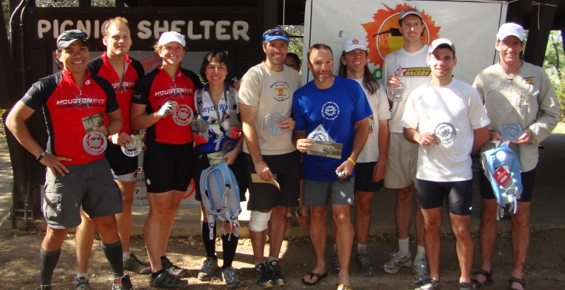
And here's a picture of all three top finishing teams posing together after the race:
Thanks to Art and Robyn for putting on another great race! And it was fun seeing all the other teams out there!
|