Too Cool Spread Your Wings 2015 Race Report
May 23, 2015Camp Eagle, Texas
by David Bogle
|
It's hard to believe that this is the 10th year of the Spread Your Wings adventure race. It is even harder to believe that I've managed to race in every single one of them. This has always been one of my favorite races, and this edition did not disappoint. I think for the race directors (Art and Robyn of TooCoolRacing.com), it is easier when they have so much exciting terrain to choose from along with a camp (Camp Eagle), that is constantly improving and changing the property.
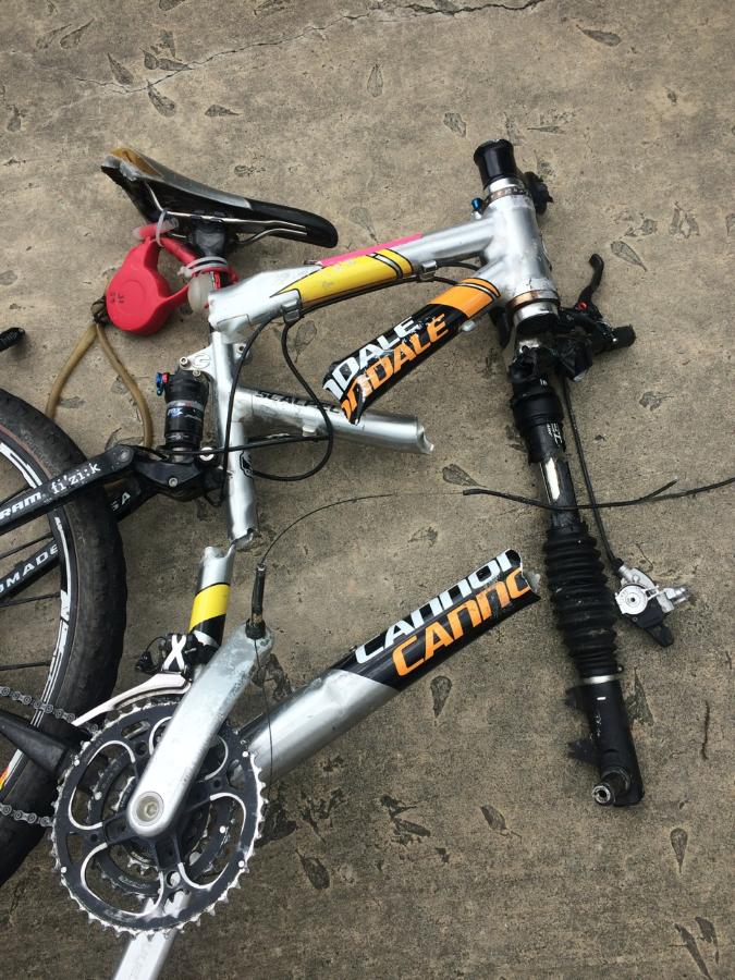
My team for this race was Julie Standing (who also raced the very first race with me at Camp Eagle back in 2006), Chris McWatters, Andrew Allison, and me - David Bogle. Yes, I had a stacked team for this race. Chris is a former resident of Camp Eagle, and Andrew is still a full time resident of Camp Eagle. Their knowledge helped with a few items, but this race takes us to many places that camp staff never goes. The real adventure started with the team traveling to camp. Friday about noon, I got a panicked call from Julie that she just "lost her bike". It turns out, she had her bike on a roof rack and it came off going down the interstate. A big rig or something likely hit it before she got back to it. Here is the result... (This might take more than duct tape to fix!)
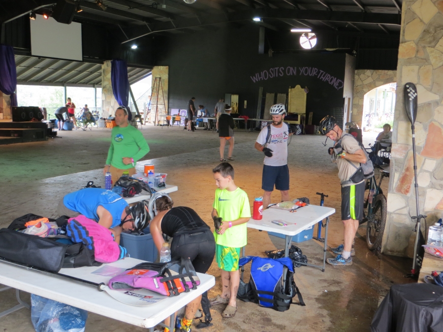
Fortunately, I was able to bring a spare bike for Julie to use. Racing on someone else's bike for the first time is more difficult than you might imagine. Once at camp, I swapped out various parts to get the bike to fit Julie as best as we could. There was virtually nothing that we could salvage from her old bike. Andrew was busy training incoming camp staff, but I did get a chance to meet him briefly. This would be Andrew's second adventure race ever. The weather this year was looking pretty interesting. It had been raining a good bit for the previous week (great for Texas, bad for areas that flood easily like Camp Eagle). Thunderstorms were in the forecast along with predictions of lots of rain. For me personally, I prefer cool rain to severe heat any year. Saturday morning was the race start (9am). We all met up pre-race to setup a small transition area (TA). We moved our TA from out in the field to under the large pavilion in case of rain. There would be a lot of teams doing the 12 hour race this year - about 30 teams (TooCool did not offer an 18 or 24 hour race this year). My goal was to try and win this overall this year. The team was all in good shape and the weather would not be too hot. Winning would not be easy as there were a few other strong teams competing. At 7:30am, we were given a quick pre-race meeting and then maps were handed out along with a course booklet. The format for this year was that the RD's would give us most of the checkpoint (CPs) coordinates before the start of the race so we could spend time plotting/planning our race ahead of the start. The RD's told us that no team would likely get all the CPs in the 12 hour time limit; this would be especially likely given all the bad weather and soggy trail conditions. Our team headed off to plot all the points on our map. I plotted the course and it was not immediately obvious to me that we would not be able to get all the CPs if we were able to move fast and not have too many navigational issues. The race order would be:
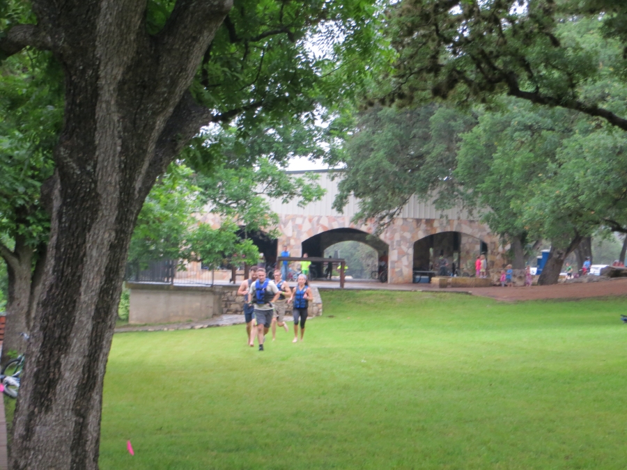
It was not raining at 8:30am for the final pre-race instructions. We were told that all CPs were optional, nothing mandatory. Whoever gets the most CPs in the fastest time is the winner. Legs must be done in order, and once you are past a leg, you couldn't go back and get ones you had skipped (this was enforced via a new passport for each leg). The RD's told us more thunderstorms were expected so they would allow teams to do the swim leg at any time during the race, but if lightning started, the waterfront would be closed. There were four CPs during the swim leg and this leg could be finished very quickly, so we decided we would get this done as soon as the prologue ended. Time to get racing! The run through camp had all the 12 hour teams and all the 6 hour teams running together. It was very crowded and we heard there were some obstacles, so we all tried to be near the front of the pack. Chris and one other guy led all the runners with Andrew, Julie and I holding spots in about the top 10-15 people. At the end of the run, we had to put on wristbands for the swim leg. This was so that every teammate could punch at each location to prove we all swam the whole distance. It was a cold start to a race plunging in the river, but other than that, the swim went just fine. There were a couple other teams in the water with us that we knew would be our big competition for the day (XMA and Easy). Leg 3 now done early, and reverting back to the correct order for the other legs.
Leg 1 - This was a trek (running or walking) leg around the main activities at camp. This was very nice to have two Camp Eagle folks with me. None of the navigation was tricky, but it was one less map for me to have to look at. First we headed to the Terrain Park for a ride on an off-road scooter. We each had to maneuver a scooter through an obstacle course. This is where 2 or 3 person teams had a big advantage as we only got one scooter per team and we each took a turn (we were in the 4 person co-ed division, but we still like to race against every team). Next up, we went to the archery range. In this challenge, Chris chose to shoot an arrow, but instead of hitting a standard target, they gave him an arrow with a big cushion on the end and he had to shoot me (Dave Bogle). Chris hit me on the first shot, so we were done. Next up was a brains or brawn task where we could either roll a bowling ball and try and make it stop in a hula hoop or run back and forth memorizing a 5 by 5 grid of colors. We chose the bowling first, but after 4-5 attempts it became obvious, this was harder than it looked. We switched to the brains task and my teammates quickly completed it. (I am color blind, so memorizing colors was not really possible for me). We had a couple more CPs to go then the leg was done.
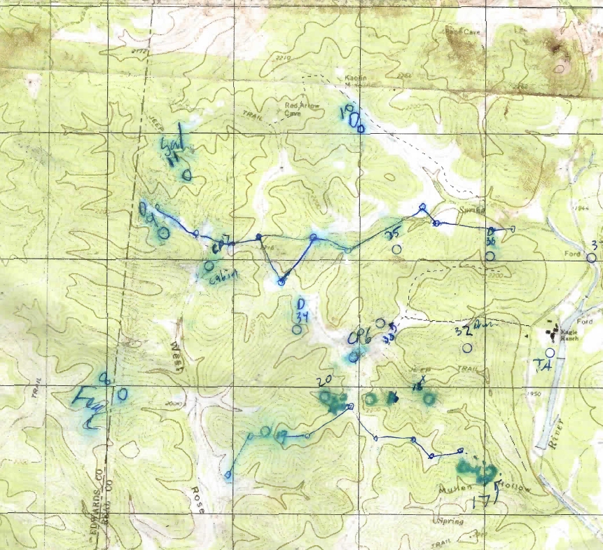
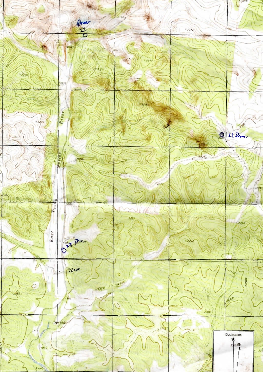
Here is the main race map we used, even though it is waterproof and I had a waterproof map case, it still got washed out from moisture... this made navigation later even more challenging!
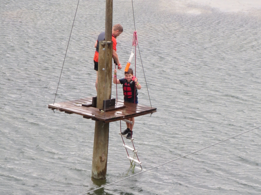
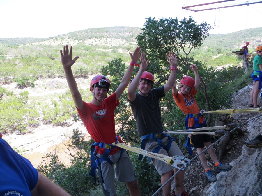
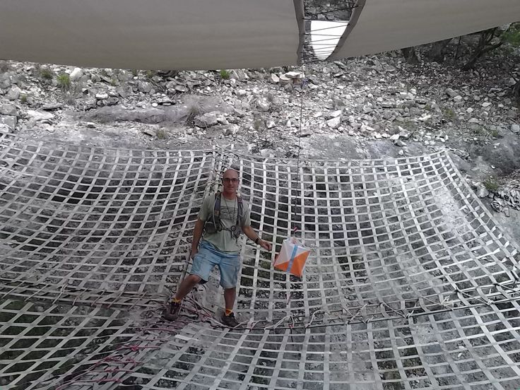
Leg 2 - I think we got out of camp first, or close to first to start this biking leg. I recall seeing a couple teams heading out on bikes, but hard to know if they had chosen to already do the swim leg or not. We only had two CPs plotted for this leg (CPs 6 and 7) but we were told there would be more CPs to plot at the second location. First up was a point at the windmill (CP 6). This meant all uphill biking to one of the higher points around. With all the wet/muddy trails, we actually chose to take a longer route on a road to get there. I feel the decision was smart after later seeing the muddy trails. There was another two person male team making the long climb with us. One of the guys fell behind in the steep parts, so our team got to the windmill first. With that CP done, we now headed to a place called Prospector's Cabin. We happened to know just how to get there, so we did not have to spend much time focusing on navigating. At the cabin, we found a poster with several other CP coordinates to plot. It was lightly raining and humidity was at 100%. This created difficulties for me as I need reading glasses to see the maps and they kept fogging up. We plotted four more CPs and were off as the other two person male team was arriving. We headed off to grab all four CPs (8-10). On our way biking to CP 8, we hit some nasty super sticky mud. This actually locked up the wheels on all our bikes to where we could no longer pedal (or push them). I had us all drop bikes and just run to this CP as it would be an out and back leg so a good spot to drop bikes. Up a draw to a big hill and we punched this CP and back to bikes. CP 9 and 11 were pretty easy. CP 10 was a little bit trickier just because the road shown on the map was not accurate at all. We hit it just fine and now we headed back to TA. Leg 3 - Swim - No, wait, we already did that leg first, so on to... Leg 4 - Trekking... yeah! I am in good running shape, so was happy to be on foot. This leg would cover CPs 16-19. (We are allowed to get the points for each leg in any order, so as you will notice we just pick an optimal order). I felt the navigation for me would be more optimal to do 19, 16, 18, then 17, so that is the order we picked. This would mean a long run to the far point, but the team was moving well and running most of the uphills also. I had drawn in some fences (you can see them on the map) that I have memorized in years past, but I must have screwed them up in the area of 19 as I planned to use those fences as my attack point. CP 19 was at top of a draw (this means, the draw pretty much stops at this location). My attack plan was from the top, but we could not find the start of this draw from the top. After failing to find it a few times (based on my poor memory of fence line locations), I chose to take us to the very bottom of the main creek, locate the correct draw the go back up. This worked perfectly, but took extra time and energy. Next was CP 18, on a small spur. This spur is really pretty small, but we got it no problem, 16 was no trouble as we attacked it from the top and hit it fine. On the way down the draw we ran into a couple of teams coming up the draw so we all said hello. CP 18 was done, now only one point left which was 17. This one was in a cave (Eagle Cave from how it looked on our maps). I knew how to get there, but Chris and Andrew said they knew a small shortcut, so I trusted in them and they took us directly to the cave. Now it was just time to get back to TA. We took the route back to TA that I knew to get to the cave. TooCool was very nice to put a big sign at the trail intersection for the cave, so that would make it super easy to find for any teams doing it in the opposite order of us. There was a ropes section on this course that we were allowed to do any time between noon and 6 pm. The ropes section would close during any lightning. This ropes course was only worth one CP and it would take a while, but looking at our progress I still thought we had a chance of clearing the course, or coming close, so we went ahead and did the ropes before getting back to TA. This course was a long Sherpa line (a steel cable bolted to a cliff, where you traverse a very narrow trail while clipped onto cable), followed by a rappel off the cliff back to the starting point. It was a big loop but we all knocked it out pretty fast. Here is a picture from the following day on the Sherpa line.
Leg 5 - Back on bikes. HUGE thanks to Jason Mittman, who cleaned our mud clogged bikes before we started this leg. This was a rather long bike leg to the north up the county road for 3 CPs. One was pretty close, then 2 that were pretty far. I had planned early to eliminate one of these points as I knew it would take a long time to get. The road was wet, but it was not muddy so we moved pretty quick. We got CP 23, then CP 22. CP 21 was up a long climb and to the east on Green Valley ranch property. I have been in that area once during a previous year and I recalled the jeep roads were in pretty good shape in years past. Based on time, I still felt we had to go for this point, so we did. It was a long climb to start, but we did get to see some cool exotic animals, none of us even knew what the animal was (this is an exotic hunting ranch). The weather was starting to look pretty bad as we approached the CP location. In the distance, the sky was turning black and we could see lots of lightning (not good when we are on bikes on top of the highest point for many miles around.) At CP 21, we came across a two person male team who must have been doing this loop in the opposite direction of us. I think we got in the draw, grabbed the CP and got out of there just ahead of the other team. Now it was time to get back to TA. We now had a nice long, very fast downhill back to the main county road. We did make it back down low and to the county road before the storms hit. The county road here is a poor quality dirt road, which quickly filled with water and mud, but we made it back to TA in one piece. Leg 6 - We were supposed to do a paddle leg which was not too long, but due to the storm and lightning, the paddle was closed. (If the weather cleared, we would have the option to do it later in the race). We were a little bummed as it would have been a nice break to sit in the boat and recover a bit. I had been pushing the team pretty hard in the race so far (and they were all doing great). Leg 7 - No paddle break, so right back on the bikes. This time, it was a bike leg on the mountain bike trails around the camp (there are many miles of very nice singletrack!). Andrew was not happy as he helps maintain the trails and you simply should not ride them in rain as it really deteriorates them, but he rode along with us. It also really started lightning and we all were getting nervous. Julie was really upset and said we should stop. I let Chris and Andrew do the nav on this section since they ride these trails all the time. Julie and I were not as fast on bikes so this gave us time to just concentrate on biking and avoiding lightning bolts. About halfway through, we chose to stop and shelter under a building. We were all soaking wet and it was still pouring rain. It did not take long to get cold. After about 15 minutes, it seemed as if the worst of the lighting had moved off to the north so we decided to move on. There was still the occasional bolt of lightning, which was rather scary. Our last point on this leg (CP 37) was at the end of the cable bridge. I mention this as later Saturday night, the rain created a huge flood wall which washed this bridge away!
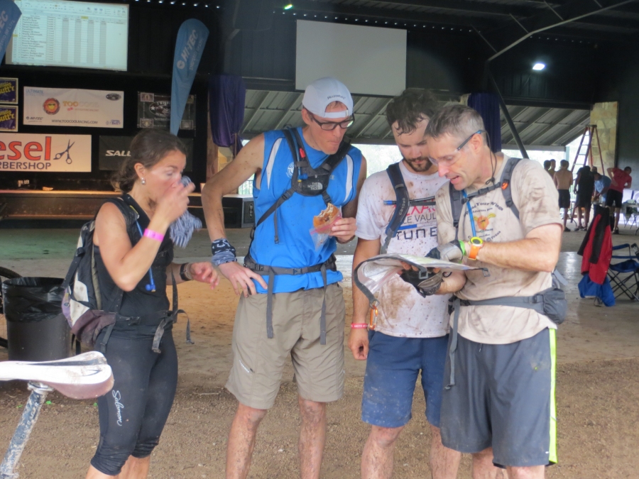
Leg 8 - The paddle was still closed and likely to not re-open based on the weather, so we started the last trek with lots of time (I think more than three hours remained before the 9pm cutoff). The rain was really pounding and I could no longer keep my reading glasses clear, so I had to really rely on Chris and Andrew's younger eyes to help me see the map. It sure stinks to have old eyes! We had CP 32-37 for this leg. Looking at the map (when I could see it), I figured a couple of them would be tricky, and we had a good bit of land to cover. CP 32 had a clear navigation plan, but Andrew convinced me to take a trail in the area which is not on maps (zip line trail). For travel, it was great, but in the pouring rain, I lost track of our rough location on the map. We looked for the CP in a few draws, but could not locate it. I had us go to the top of the hill because up there, I was sure I could hit the right draw. So we did that and hit the point very fast (we were actually in the right draw earlier, just a little too low). CP 33 was no problem. CP 34 was my favorite point in the race. The camp had placed a large cargo net across the draw. Normally, I suspect this draw is nice and dry, but today, with all the rain, there was a cool raging river below the net. Here is a picture of ART (the RD), setting this point before the rains came.
Three more CPs to go and time was getting a little tighter, but at least we were at the far point of the course. Next up for us would be CP 35. There was a trail that got us pretty close. From there we headed up the main draw looking for a small side draw. This side draw was very small and hard to see from the main creek, but I think we went up the right side draw the first time. Only two CPs left in the race. CP 36 worried me a bit mainly because of our attack plan. There were several trails and roads in the area that are not on the map. We took some of those but ended up going up the wrong draw looking for this CP. I knew, again, this one would be easier to find from the top of the hill, so since we were already close to the top (in the wrong draw), we just went to the top then came back down the correct draw to grab this CP (and we saw several teams coming up from the bottom to get this one). One last CP at the road/river intersection that was easy to get before heading back to the finish line. We managed to clear the course in under 11 hours. Thanks to TooCoolRacing.com, Camp Eagle, and my great teammates who made this a super fun race. See you next year at camp. A rough online map of the course
|