Too Cool "Big Chill" 2007 Race Report
January 27-28, 2007Bastrop/Smithville, Texas
by Marcy Beard
|
"And I would walk 500 miles," just please, no more biking or paddling!
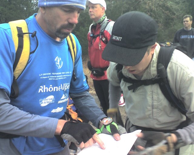
John and I raced in the Too Cool "Big Chill" 24-hour race last weekend, in and around Bastrop State Park. Normally we'd race with my brother Kip, but he was volunteering instead so he could make it to a half-marathon on Sunday morning. We decided to forego a shot at the race awards (given to 4-person co-ed teams only) and be a 2-person team. I haven't spent enough time with my hubby lately; this would be a nice fun weekend together. The race began with a sprint to the school buses - well, we could have walked, but we wanted the front seat in case there was an advantage to getting off first. Ha ha! The main benefit was that John could clown around to the music and at least the lady in charge could see him and laugh about it. The rest of us had blindfolds on so we wouldn't be able to see where we were going. We jammed to Queen and kept track of the turns the bus was making. The lady in charge handed out instruction sheets while we were still blindfolded. It felt like we drove past Rocky Hill Ranch in Smithville, went up the hill, and turned left... to where? And then we stopped. We were granted the gift of sight again, and then allowed off the bus to find ourselves at an intersection in a rural subdivision. While my pupils tried desperately to make themselves smaller, we plotted two checkpoints and the location of the bike TA where we had dropped the bikes the night before. |
| Without knowing our exact location, it appeared we needed to head west to the edge of the subdivision and then north to the first checkpoint. I was just wondering whether we could leave when Robyn yelled "GO!" I heard some general confusion behind us as we ran off down the road. The side roads made sense and soon we were climbing through the fence at CP1. |
|
John punched the passport while I asked which way to go next. Our communication and map-reading got a bit confused, so we went west instead of testing a path to the north that was probably more direct. We ended up on a bike trail in the woods, eventually doing a bit of bushwhacking and then finally popping out at the pipeline where a bunch of racers were walking toward CP2. A short hop up a creek led us to the checkpoint, and on the way back out we greeted Team Backpacker for the first time. They're a fun team and always good race companions and competitors.
Next goal was to find our way south through the Rocky Hill Ranch bike trails to the TA. Teams were going in different directions, but we and Backpacker decided on a direct route through the woods. Soon we hit the west fence line and followed it down the ranch boundary. I made the mistake of staying on the straightest course back (Fat Chucks), which was a wide road that went up and down and up and down and through the stickiest mud in the area. Good thing we would have a chance put that learning to use. |
|
We got our bikes and helmets together while John verified that we could leave the climbing gear there. We didn't think to look inside the clear plastic bag that was holding said climbing gear, or we would have noticed that the bike repair kit was also in there. John realized it about a mile out, and I spent a couple hours hoping like heck that we wouldn't regret not going back for it.
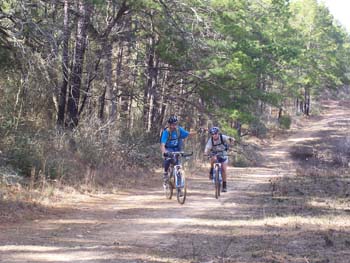
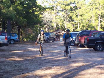
We climbed on up toward our first required trail, Karaway. There were a couple options for getting there, and our choice included using a beautiful dirt road on the west side of the ranch to skip a bit of single track. We wondered how far that road might be useful, but we got back on trails to be sure not to mess up the nav. Once on Karaway, my biking legs kicked in (weird!) and we sped in and out through the trees. My favorite little trail - it makes me feel fast even when I know I'm not. |
|
Backpacker caught up to us at the next checkpoint, then we all started on Off The Lip. Last year we did this trail in the dark, on tired legs, and in the backwards direction - none of which is recommended, particularly the latter. Much better this time around. Several teams passed us, and I had a bit of trouble through those drainages on the west side like normal, but overall it went OK.
Then we passed some flagging hanging across the trail at the last section of Off The Lip where Frontal Lobotomy starts, and I stopped us to look at the map. Just as I had decided that we should go under the flagging, another team rode by and the lead guy said that Frontal Lobotomy connects up to Bottle in Front of Me (which was a required trail). John said that this guy knows the trails, just follow him. I wasn't sure about going under flagging anyway, so I agreed. Later we realized that was a mistake, resulting in extra distance - "listen to your brain!" I yelled at myself. On the sandy road toward the next trail, Longhorn Loop, we found Art at the checkpoint. Hi Art! At the start of this trail I rode a bit slower to recover from some of the push I had put on my legs. It was interesting to ride without as much race pressure as normal. My main goal was to be strong at the end of the race, many hours later, so when I felt good, I rode fast. When I felt a bit tired, I backed off and recovered. It was good for long-term endurance to mete out the energy more evenly than normal. I think I learned this from racing solo a couple months ago. We passed a couple teams having mechanical problems, but unfortunately couldn't help them at all since we didn't have a single allen wrench between us. There was a bit of water in the little creeks, a bit of mud in different places, and some trees down over the trail, but for the most part the trails were in great condition. The sun even came out! What a nice change from the recent ice storm and freezing temperatures. As we followed the Tris Cross trail over to Omar's Howl, we went back-and-forth with one team that was riding pretty well. The only reason we'd catch up was because occasionally the woman would fall off her bike. She was certainly gutsier than I, and faster when riding. We saw them again at the top of the big drop on Omar's, and they let us by. At the bottom I rode into a wide puddle and found that it was dang deep, maybe a whole foot of water? I'm not really clear on that part; all I remember is yelling hysterically as I frantically peddled to the other side. Somehow I came out of it without stepping into the water. One more huge puddle like that, a lot of laughter, then we hit the sweet little dispy-dos leading out to the field. Here we found Kip at the bike drop - Hi Kip! He told us we were in 8th place. We left the bikes and helmets and went off in search of 3 trekking points. John mixed a SPIZ for me as we trotted off towards the woods. We discussed our miscue at CP1 and decided that he would give me the map as he went to punch the checkpoints so I could formulate the exit plan. We chatted briefly with Sarah Brown's team as we jogged along the jeep trail, then stopped at an intersection to look at the map and the other teams going in various directions. We decided to head west along the road to the park boundary, but it took us awhile to come to that conclusion. Once we got there, it was an easy matter to locate the right drainage and cut in to find the checkpoint. The next CP was south, so we followed contours and a bearing until we found a little creek. Having aimed off to the right, we turned left and followed the creek down to the checkpoint. Teams were grouping in the area, and we briefly greeted Team Werewolves as we all took off galloping toward the third CP which was further down the same creek bed. We ended up on a high bank overlooking the checkpoint, but found it easily when we saw Beth run straight for it. John jumped down to punch and then we conferred briefly about how to get back to the bikes. I decided to stay on the creek going east, then John decided to follow it from up above, then we saw cyclists on the Omar trail so we jumped over to it. As we ran hard along the single track, we wondered if it might have been better to take a bearing straight back instead. But when we got to the bikes, Kip told us we were now in 2nd place behind Backpacker, so I guess we did OK. Now we had to get back to the front of RHR. Our instructions didn't say how to do that, except to take Tunnel of the Pines and to follow green flagging whenever we saw it. We might have taken the Tunnel and then turned around to follow the east fence line back, but the flagging directed us onto the Avenue of the Pines so that's what we did. When we hit the entrance to the next singletrack section, we greeted Team Run Amok changing a flat, checked for green flagging, didn't see any, and so headed along the pseudo-trail along the west fence. That made for quick travel heading south, and we schemed how to optimize the next part. Our plans were thwarted by green flagging leading down Black Trax. Nooooo... I hate Black Trax. I grumbled as we slid around in the mud and tried to stay on the trail. When the trail crossed a jeep road, there was no more flagging so we jumped out to the beautiful road we had followed previously. But we were foiled again - this time by a park sign stating "no bikes on this road" - oops. Sure enough, the map said the same thing, so we shouldn't have been on it in the first place. So we carried the bikes back to the trail and I suffered my way up and down, over The Wall, finally back to the easy final stretch. Finally done with the RHR trails, yay! We gathered up all our stuff, plotted the next set of points, and headed for the road. We were blasted with a strong west wind, so John towed me along this straight section while I just put my head down and peddled while trying to stay relaxed. Yoga breathing helped. On the road around Buescher State Park we stopped at a water spigot to fill up for the journey over to Bastrop. It was nice to be on paved roads briefly, so we chatted and didn't push too hard up the hills. The next bit involved easy navigation on back roads, a couple CP's on a pipeline and next to a cemetery, a brief encounter with Team Werewolves again, and some dirt road that was a bit bumpy but not bad. The last section toward Bastrop State Park on Gotier Trace was not so great - muddier, rockier, and uphill for a while. I'm not a fan of Gotier Trace. At the top we found the infamous powerline with its rutty, muddy trail, and we followed it a little ways to a bike drop. I was pretty excited that there was so little biking on the powerline compared to last year, and the trail itself was in decent condition. We greeted Robyn at the bike drop and took off on foot on a park trail, with a brief delay to go back and retrieve the orienteering map from John's map case on his bike. That map turned out to be very handy. We followed the trail around a drainage system, then cut in to locate the ropes CP. It was fun to see Rob, Rooney, Mike, and friends hanging out there. John made quick work of the Tyrolean traverse. I made quick work of half of it, then I rested against one of the tree obstacles for a minute. When I got closer to him, John grabbed my dangling lanyard to pull me the rest of the way. We crossed the ravine on foot to retrieve our packs and return the climbing helmets. I looked at the map to find we would have to cross the ravine again, sigh. On the way down, John's bungee tow rope got caught in some branches - I tried to get him to stop, but by then it was stretched WAY tight. As he waited to see what would happen, it came loose and BAP hit him on the butt. Hey, maybe that's why one of your butt checks is sore, John! We ran out to a road toward the second trekking CP. My legs started cramping slightly, so I started drinking as much as I could to get back on top of the hydration thing. We had no problems on the next two points, and we met several other teams on the course which is always fun. Back to the bike drop, on the road again. It was about this time that we realized we hadn't done this much biking in a long, long time. My butt was not happy. We rode back to the TA hoping that there wouldn't be any more biking in the near future. As we rode in, we saw Team Backpacker coming in on kickbikes, so they were about 50 minutes ahead of us at this point. I think we were slightly ahead of Werewolves for the second position. We gratefully traded bikes for kickbikes, plotted several points, and took off to answer questions about the color of signs and the names on hidden graffiti in the park. While cutting across from the road to a camping area, I learned that hike-a-kickbike is an acquired skill. |
|
Coming back to the TA we saw a 12-hour team heading out on foot, go guys! We theorized that the paddling must be next for everyone, so we hurried to get to the water while we still had a little daylight left. The next section had 3 paddling and 3 trekking CP's, in any order, so we gathered some liquids and clothes and booked it for the lake. There was a solid north wind blowing toward us as we ran/walked up the road - this was not going to be pretty.
Team Backpacker was actually launching their boots as we arrived, which meant that they had done the trekking points first. We followed them onto the water, with me making faces about the wind and the waves out there. There didn't appear to be any whitecaps, just a strong gusty gale coming down from the north. We took a bearing north along the eastern shore, while Backpacker headed for the northwest checkpoint. They're an excellent paddling team, so they were soon off in the distance. A 12-hour team flew by heading back for the take-out. A couple motorboats stirred up some side waves to make things extra interesting. Or maybe that was just Backpacker's surf. We battled the headwind, with John doing a great job on the steering end of the canoe. When we rounded the corner, we both got confused about where we needed to head for the far checkpoint. It was up a long inlet, but the only thing we could see was the north boat ramp. John tried to steer while reading the map and I tried to remember what we did last year. In the end, we took the long way around a cove, added some head-wind-battling, and wasted some daylight, but eventually we figured out what the hell we were doing. When we reached the north shore, the wind died away, the water went calm, and all was good in the world. We relaxed and shook out our shoulders that were in shock from the sudden abuse. Heading toward the long inlet, we saw a bunch of dead tree stumps sticking up all over the place. It took careful attention to avoid hitting anything, and we still slid over some sunken logs. Here's where I would prefer to be in the back of the boat where I'm used to steering. John and I had a prolonged discussion about how I should just do a draw stroke instead of telling him (in an alarmed voice) that there is a stump Right In Front Of Us! That's going to take some getting used to. Nearing the CP, we found a tree down across the water, so we attempted to beach the boat and bushwhack to the point. But the brush on shore was too thick, so we gave up and aimed the boat at the low point of the tree. More hysterical screaming on my part and we were over it. Team Backpacker showed up right as we found the point, telling us that they were discussing fried chicken. We didn't tell them we had been discussing how to paddle. We punched our passports and they were off like a flash. It was getting dark as we maneuvered back over the tree and through the woods in the water. Dusk-light made it easy to see the water surface in this direction, and we were glad we did this CP first before it got black out there. We turned on the glowsticks attached to our PFD's. The second CP wasn't difficult in the dark, and the wind wasn't bad in that area. Just a few more obstacles in the water, some more draw training, and we were back out on the lake proper. We had a bit of a side wind going across by the north boat ramp, and I was starting to wonder about the downwind trip. We rounded the last little cape to aim for the last CP, still heading west. Suddenly a wave slapped the boat from the right side. Then another. What was that? Another motorboat? It wasn't long before it became clear that we were crossing the main wind tunnel on the north end of the lake. There was hardly any room for the fetch to grow, but it was making the most of it. Strong gusts and big rolling waves attacked us from the right side, and I tried my damndest to add some diagonal to my stroke to pull the boat even slightly into the wind. We paddled hard across to the opposite shore, finding the small inlet by watching where car headlights appeared through the trees. As we pulled up to the CP (no tree stumps this time, but not as much shelter from the wind either), I started babbling incoherently about how crazy that was. I was SO not looking forward to the trip back now. I fumbled to get my poly pro top on while John waited patiently for me to steel myself. OK, time to get going or we'll both get really cold. John had a plan to avoid some of the wind by following the shore briefly before aiming across the lake. This kept the worst of the tailwind off of us initially. Finally it was time to just turn downwind and go. The gusts would come and go, sometimes kicking the back to the boat around. John would correct immediately and my draw stroke started to get quicker. We rode waves, and sometimes my paddle barely reached the water. Sometimes the front of the boat was in a trough and I pulled water into the boat unexpectedly. I could hear waves breaking to the side of us, and the only thing to do was keep paddling, keep paddling. We passed a team that was heading out, and a woman yelled at us to turn on our headlamps. "No can do!" was my answer. Taking a hand off my paddle was not an option at that point. Plus it's difficult not to blind yourself from the reflection off your hands and paddle, so I was paddling better with the headlamp off. For future nighttime paddling, we need to rig a light on the front of the boat instead. We weren't positive what to aim for on the opposite shore, but as we got close we could tell that we would need to head rather significantly to the left to get into the area where the takeout was located. The boat got turned broadside to the wind, and after one rolling wave hit us I knew it was time to beach and regroup. I pleaded with John to find a place to pull out and check the map, and he graciously agreed to do so. We slid into a small inlet, and John told me there was a road 150 meters into the woods that led back to the take-out. Score! We jumped out and went scouting for the best way to get there. It was a bit thick in a couple places but mostly an easy walk. We started back for the boat, but soon realized we didn't have a good idea where we had left it. After making a big circle and finally refinding the inlet ("Here boat! Here boat!"), we managed to relocate our ride. Phew, sometimes we make things harder than they have to be. Like if we had just headed straight downwind from the last CP... But instead we got to continue our streak of doing a portage every time we race on this lake. This time it was pretty easy, even with a high fence to get the boat over. We walked down the road, back over the fence, and found Mike Drost wondering where the heck we were. No worries, it's just us doing things a bit oddly as usual. We left the boat ("Thanks boat!") and ran down the road with a tailwind to help us along. It felt great to get back on our feet, and I was looking forward to a long orienteering section in Bastrop State Park. First we had to find 3 CP's on the way back. These we tagged easily and we were in good spirits as we ran back to the TA along the park trails. Now it's time for one of those lesson-learning things. Maybe you have been to a Too Cool race and you have seen those whiteboards where they put the times for each section for each team? Well, I have learned that the important information is not which team is ahead of you, which teams are doing which section, what the time gaps are, nothing like that. Check the top column headings and count: #3 (riding into Bastrop), #4 (kickbikes), #5 (trek/paddle), #6 (the next section), ... and #7 (what?? There's more??). You should have seen my face when they handed us the instruction sheet while saying "make sure you have your white lights and blinkies on" - more biking, nooooooooo! We were pretty deflated, and it got worse as we plotted the points and realized that we had to ride up and down both parts of the powerlines, PLUS down and up Gotier Trace again. I could never see that road again and be perfectly content with my life. We put on jackets and I put on tights (John had been wearing his all day), and slowly wheeled out of the TA. It was supposed to be a "Trike" section, i.e. Trek and Bike, but really it was 98% biking. I was hoping my toes and fingers wouldn't turn into icicles; we ended up staying relatively warm for most of it. Other teams (those that were told to skip the paddle) were out there doing the out-and-back thing to find the 4 checkpoints, and no one else seemed too enthused about the whole experience either. Oh, and we forgot our bike repair kit again, darn it! Taking it easy, we found the checkpoints without too much trouble, although one of them was deep inside a thicket. John's light was shining right at it but I saw it from the side before he did. I walked up most of the powerline hills, finding that my energy level was still OK, even if my biking legs were shot. The climb back up Gotier Trace even wasn't all that bad. Sometimes it helps to have horrible expectations. After a couple hours we were nursing our butts back toward the TA, when we passed Team Backpacker walking on the road. Oooh, look how far from the TA they are - this next trek must be big. Sure enough, we had 7 CP's to locate, including one on the powerline we had just biked from. One CP was plotted in the middle of a confusing dry ditch area that we were familiar with, so I knew that would be the money point. We plotted the points on the topo map and transferred them to the orienteering map. Time to get running. We spent just a little too much time trying to figure out clothing for this section, and then we were out of the van and on our way. Status update: As far as I can remember at this point, we left the TA about 2 hours behind Team Backpacker. While we were in TA, we heard some kind of Werewolf-type howl, so it is likely that we were just ahead of that team for second place. Of course, we're a 2-person team and they are both 4-person teams, so they're the ones aiming for the official prizes. I continued to focus on my main goal: Being strong in this last section. 7 CP's, 7 hours remaining, GO! The first checkpoint was in a draw not far from the TA. We ran the trails, followed contours, and hit it right on. I started calculating against a goal of 30 minutes per CP. Out to the main road, down to another trail, and we were aiming for another draw. The second CP gave us some problems - I had assumed it would be in the main draw, but when we didn't find it, I rechecked the main topo plot and saw that it was off to one side, so it must be in a side draw. We started checking those. In the area that made the most sense, we still didn't find it. My next plan was to try the draws on the other side, at which point I got really confused about which direction we were facing. I gave John some instructions about where to check, at which point he located the CP. Yay! Then I looked at my compass and had no idea why it was pointing backwards. I was totally turned around, but we found the CP anyway. That should NEVER happen. Anyhoo... we got out of there (in the right direction) and back on the trail. We had a long way to go for the next CP on a little pond. We knew that Backpacker was doing the loop clockwise, and we were going counter-clockwise based on attack points for the difficult CP's. So I expected to see their lights anytime now. John let me lead on the trail, and I felt so good that I was running everything except the uphills. I was hoping the energy would last through the whole section. Run while you can! We were still ahead of schedule for 30 minutes per CP. At the little pond we saw some lights ahead of us, but it was a team going in the same direction we were. We tried to cut to the south to find a direct trail going east, but that trail obviously doesn't exist anymore, so we did some bushwhacking for about 400 meters to get back to the windy trail we were on before. We caught up to the same team at the next pond, so our "shortcut" obviously wasn't worth it. We said "hi" to the team as we all rounded the pond to the CP, and then we moved on to find the powerlines. I assumed that we missed Backpacker during our "shortcut", but as we ran up the powerline trail we saw their lights and reflective clothing coming towards us. What the heck? They told us that they spent over 2 hours on CP29 (the difficult one) and didn't find it. Werewolves had still been searching for it when they left the area. Oh my gosh. Here we were, two (or three) teams about equal distance from the TA. They mostly had trails to follow back but more CP's to find. We had killer CP29 (which may or may not be there) and some cross-country travel in front of us, then roads back to the last checkpoint. Good luck! And... GO! We found one CP off the powerline and then took a bearing toward a long dry ditch that we hoped would lead us to the right area of CP29. We took our time making sure we didn't mess up the approach. We found the long dry ditch and John led us along an old faint path alongside it. He was great with route-finding and bushwhacking. I worked the map, he got us to the right area, then we both converged on the CP's. We could hear voices and saw a light in the distance once, but never did see Werewolves out there. It was quiet as we stalked within a couple hundred meters of CP29. We followed little dry ditches, checking out parallel ditches and different possibilities as some of them petered out and others split off. I got really excited when I saw something reflective up ahead, but it turned out to be the permanent orienteering point. Huh, that one is usually a lot harder to locate! After moving through the area, I was sure we had missed it, which didn't surprise me based on Backpacker's report. So it was in a draw, but which one and where? I pulled out the topo map to study the original plot. It looked like the circle was to the north of the "main" ditch (whatever the "main" ditch was). Based on our problems back at the second CP, it seemed like we needed to scour the terrain to the north side of the drainage system next. We spread out a little and walked a path parallel to the ditches, looking for anything that resembled a tiny draw, scanning every direction and thinking about possibilities. Just as we started hearing voices from the team behind us, I turned and spotted the checkpoint. Jackpot! It was about 50 meters from the permanent CP but could only really be seen from the north, not from in the draw. That seems evil. John punched it and we moseyed on out of there while the other team talked strategy. They were so close to the checkpoint, they might have found it immediately or walked right past it, we don't know. We booked it to a trail that led out to the park road. One more checkpoint! We ran as much as we could, and John pulled me up some of the hills. It was really nice to be wide awake and feeling strong in the early morning hours, that is certainly not always the case in an overnight race. The final CP was near the lake, and John wanted to climb up and over a little hill to approach it from the side. Going directly up the drainage would involve pushing through some crappy brush and possible wading through something resembling a little swamp. So I agreed to go over the hill. It would have worked better if I had done a better job of transferring the circle to the orienteering map, because we went the wrong way up the drainage at first. We did find another permanent O-point, whoopee. Finally we headed back the right way and eventually found the point. We climbed back up the hill and headed for home. One more little down-and-up trail, and we were trotting into the TA. It was really quiet. We walked up to the check-in desk and woke up Robyn. She said "you're the first ones here" - hey cool! We turned in the passport and booked it to the van for a short nap. Team Backpacker arrived a couple minutes later, followed soon after by Team Werewolves (who also did not find CP29), so that was the official finishing order. It was fun talking with teams about the race the next morning, even though I don't think I gained coherency until at least Tuesday. We found out that only a few teams did the paddle, one team did some swimming too, and some of the 12-hour teams turned into 18-hour teams. What a night! |
| Thank you so much to Art and Robyn of Too Cool Racing, all of the awesome volunteers, all the other teams who are so much fun to race with and against, and to whoever ordered up the beautiful weather (except for the wind part). We enjoyed it! |